Nova Scotia Archives
Built Heritage Resource Guide
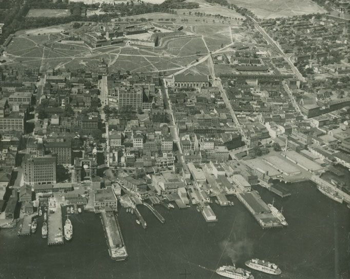
Aerial View Showing Central Business District from the Harbour to Citadel Hill

E. Arthur Betts, “Places of Worship on the Halifax Scotia Square Site”, Nova Scotia Historical Quarterly, vol. 9, no. 3, September 1979, p.215, describes the neighbourhood demolished to build the development:
“Those familiar with the busy shops and high office towers of the Scotia Square complex in downtown Halifax will not find it easy to picture the area as it was a century or more ago. Near the original townsite the streets were early laid out, and soon became lined with homes, stores, warehouses and public buildings. Argyle, Grafton, and Albemarle (later Market) streets all extended north to Jacob Street, which ran east down the hill to Lockman (now Barrington) and was not far from the present extension of Cogswell.
Then north from Jacob ran Starr to Hurd’s Lane, and Poplar Grove, a no-exit street. From the corner of Barrington and Duke to Hurd’s Lane may be found the sites of nine places of worship...”
The right half of the photo shows the neighbourhood which was razed for the subsequent construction of Scotia Square and the Cogswell Street Interchange.
Date: ca. 1935
Photographer: Nova Scotia Bureau of Information
Reference: Nova Scotia Archives Photo Collection: Places: Halifax: Air View