Nova Scotia Archives
African Nova Scotian Diaspora
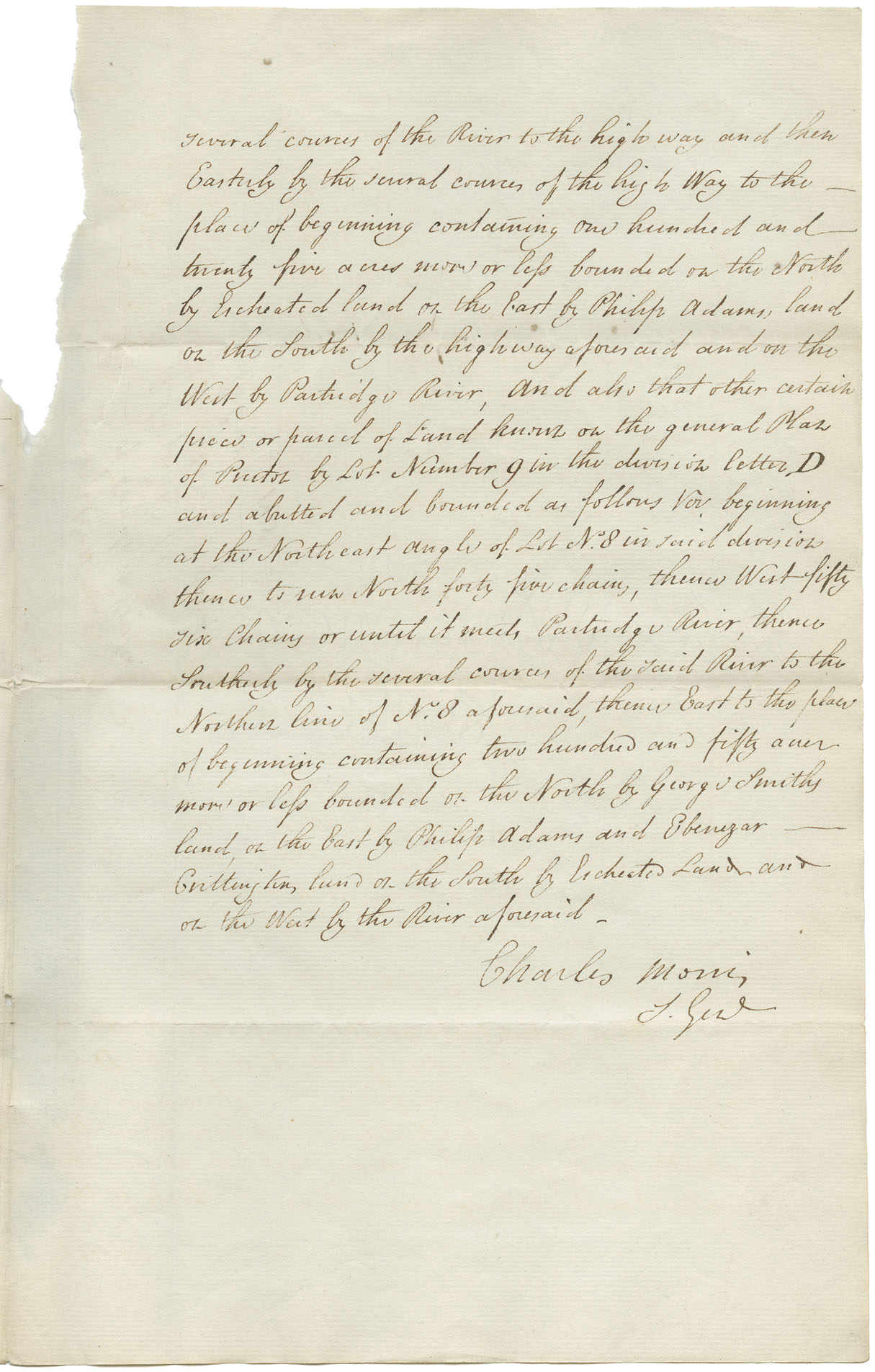
A further description of lots in Preston, relinquished by the proprietors for the use of the Black Refugees. Signed by Surveyor General Charles Morris
note: transcription publicly contributed - please contact us with comments, errors or omisions
several courses of the River to the high way and then Easterly by the several courses of the high way to the place of the beginning containing one hundred and twenty five acres more or lefs [less] bounded on the North by Escheated land, on the East by Philip Adams' land, on the South by the highway aforesaid, and on the West by Partridge River, and also that other certain piece or parcel of Land known on the General Plan of Preston by Lot Number 9 in the division Letter D and abutted and bounded as follows viz beginning at the Northeast angle of Lot No. 8 in said division thence to run North forty five chains, thence West fifty six chains or until it meets Partridge River, thence Southerly by the several courses of the said River to the Northern line of No. 8 aforesaid, thence East to the place of beginning containing two hundred and fifty acres more or lefs [less] bounded on the North by George Smiths land, on the East by Philip Adams and Ebenezar Grittingtons [?] land on the South by Escheated land, and on the West by the River aforesaid.
Charles Morris
[illegible]

Date: 1818
Reference: Commissioner of Public Records collection Nova Scotia Archives RG 1 volume 419 number 99