Nova Scotia Archives
Mi'kmaq Holdings Resource Guide
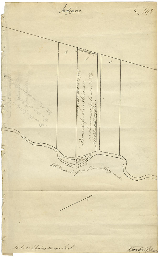
Map of lands on S.W. branch of the Marguerite River [Margaree?] reserved for Mi'kmaq
note: transcription publicly contributed - please contact us with comments, errors or omisions
Indians
145
8-7-6
S.40°.W(1816) 20.06 ch
7
S.65 °.E. (in 1816) 110 Chains
[upside down]
Reserved for the Micmacs
see the warrant for Janet McRae
N.65.° W.(in 1816) 97 Chains
[narrow area between lots 7 and 6]
6
[Written upside down in pencil]
All on this plan is on the Big old plan
Take the names from this plan
[river and 2 islands at bottom of drawing]
Micmacs [written on island to right]
Alder islands
S.W. Branch of the River Marguerite
[Drawing of arrow to show north?]
Scale 20 Chains to one Inch
[drawn?] by WEB [1828?]
![Map of lands on S.W. branch of the Marguerite River [Margaree?] reserved for Mi'kmaq](/images/mikmaq/201607424.jpg "Map of lands on S.W. branch of the Marguerite River [Margaree?] reserved for Mi'kmaq")
Retrieval no.: Commissioner of Public Records — Mi'kmaq and Government Relations series Nova Scotia Archives RG 1 volume 431 number 145