Nova Scotia Archives
New Ross: From Family to Community
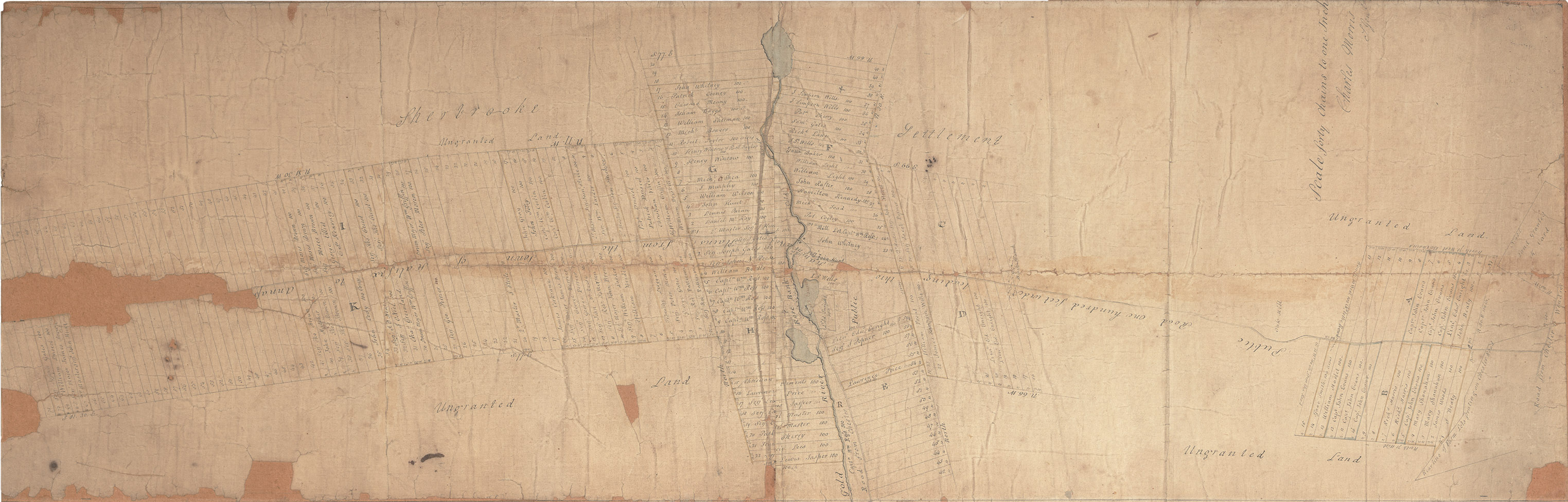
Map of land grant made by Charles Morris

This map was transferred from the Ross Farm Museum to the Archives in 2015. It, and an original land grant, would have been given to William Ross at the time the land grant was officially made in December of 1819. It clearly shows that the settlement was arranged with each lot having frontage on the Gold River or on the “Public road one hundred feet wide heading thro Hammonds Plains from the Town of Halifax to Annal 100 foot wide road from the Town of Halifax to Annap[olis]”. The scale of the map is 40 chains (half a mile) to one inch. The road from Chester to Windsor appears on the left edge of the map.
Reference: Land Papers Nova Scotia Archives Map 2015-038 number