Nova Scotia Archives
Woolford's Surveys: The Roads from Halifax to Windsor and Truro, 1817-18
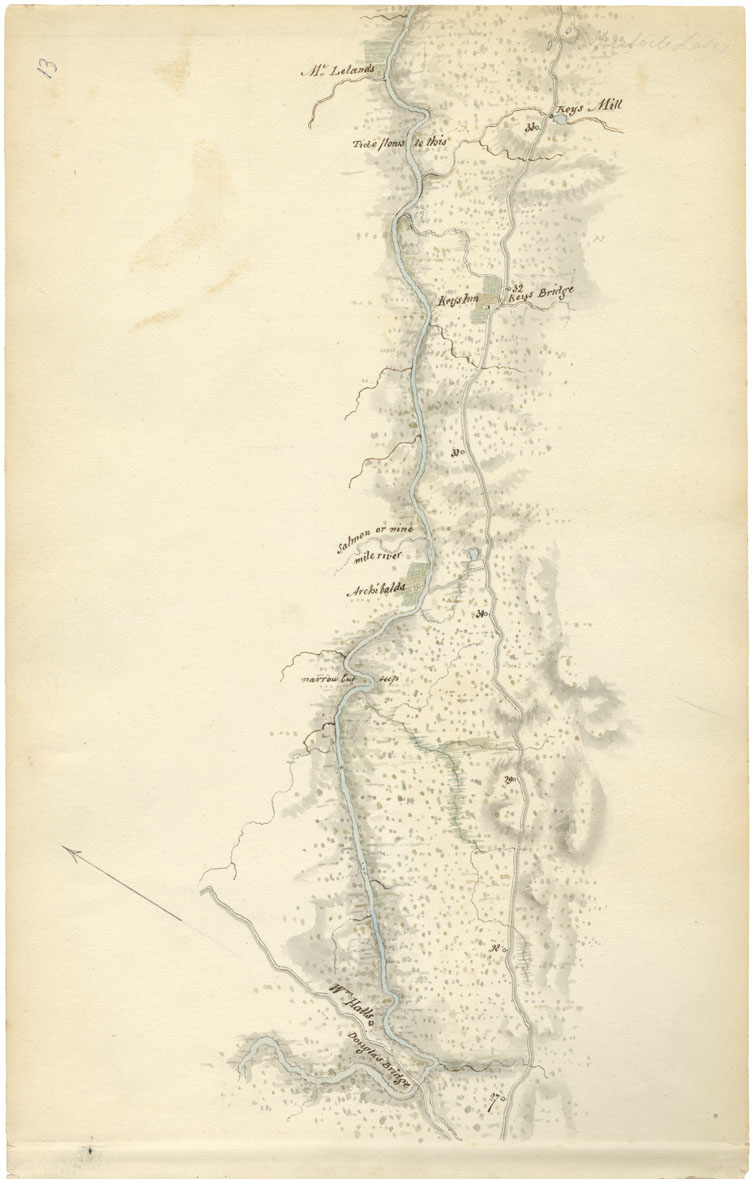
Sheet 13: Mile 27 to Mile 33: Enfield

On this map, Woolford identified Douglas Bridge and Key Bridge; the properties of Willliam Hall, Archibald, and McLelan; Key's Inn; "Narrow Cut deep"; and the Salmon or Nine Mile River, also noting that the "Tide flows to this" at mile 33.
In September 1817, Governor Dalhousie stayed at Key's Inn but recorded that "Yesterday morning we left our miserable quarters at Key's at daybreak. I must however say that we had a very good supper, & that the people, very poor, did everything in their power to accommodate us." The following September, Dalhousie again stayed at Key's and spent a "delightful day" hunting. He commented, "The Partridges were so numerous by the side of the road, and so stupid that I killed them without getting out of the carriage. Generally we did not stop to let Ramsay shoot. He had a short little rifle that did not carry shot well, but still he killed 2 brace (pair). I shot 5 hare & tired of it. I might have killed 20 without stepping out of the carriage." Near mile 27 at William Hall's and Douglas Bridge, Dalhousie observed that the stream was shallow and was filling up more every year with logs which formed sandbanks through which beds of strong reeds grew.
Date: 1817-18
Draughtsman: John Elliott Woolford
Reference: Nova Scotia Archives Map Collection: 15.1