Nova Scotia Archives
Woolford's Surveys: The Roads from Halifax to Windsor and Truro, 1817-18
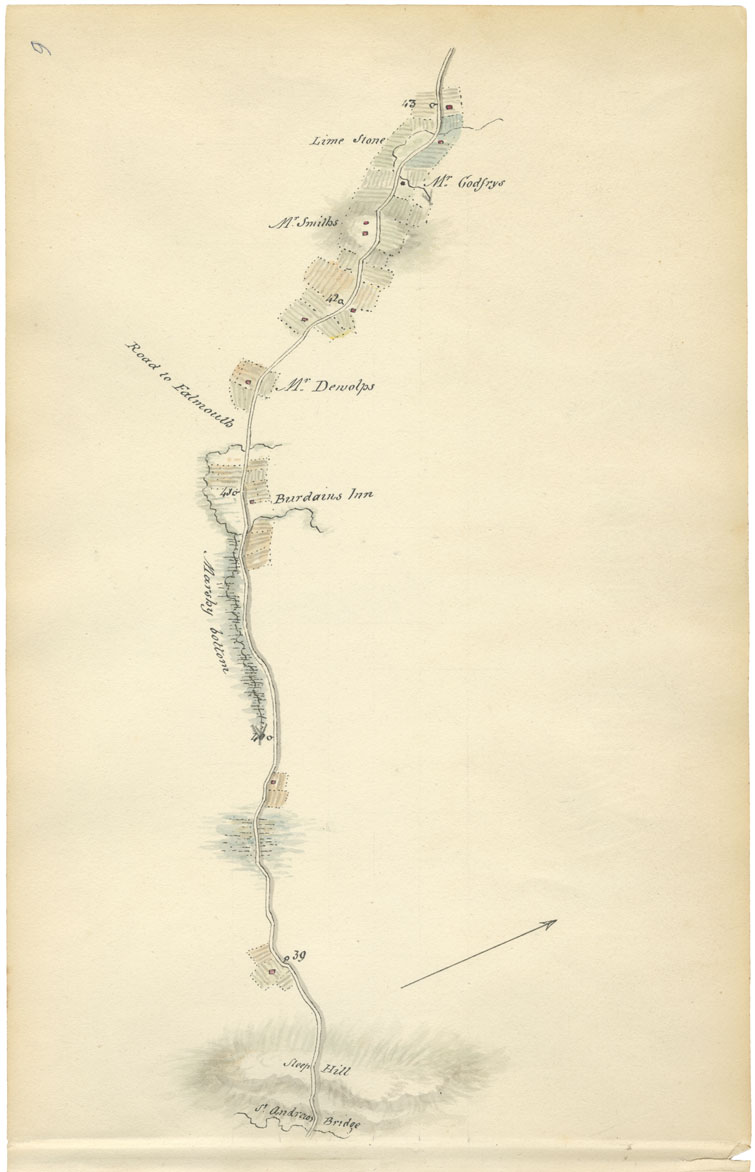
Sheet 9: Mile 39 to Mile 43: St. Andrew's Bridge to road to Falmouth

Sites identified by Woolford on this map include St. Andrew's Bridge, Steep Hill Marshy Bottom, Burdain's Inn, the road to Falmouth (Windsor Back Road), limestone outcroppings, and the properties of Mr. DeWolf, Mr. Smith and Mr. Godfry, whose property was near a brook and limestone.
Smith, the Sheriff of Hants County, helped Lord Dalhousie in February 1817 when the Governor, travelling by sleigh with a group of friends, encountered the road clogged and impassable with about 10 inches of snow. Smith brought his servants and three pairs of horses to beat down the snow, accompanied the Governor's group for another seventeen miles though more deep snow to Mount Uniacke, and then returned home.
Date: 1817-18
Draughtsman: John Elliott Woolford
Reference: Nova Scotia Archives Map Collection: 15.1