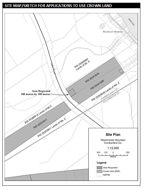
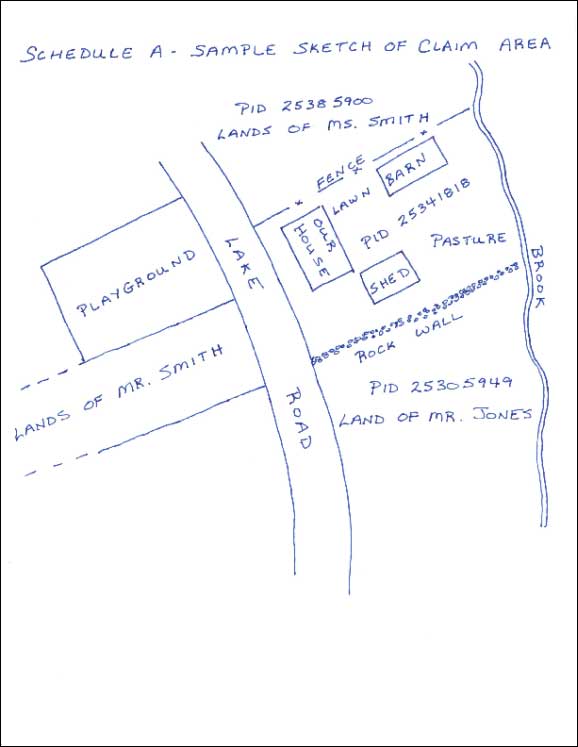
How to prepare a site map and/or sketch
For ALL applications to use or have access across Crown land, please enclose a site map or sketch that shows the following:
- All Crown PIDs or portions of PIDs that you want to use or have access across
- Include the size and shape of the area(s) requested; or
- Describe the location of the access route.
- The location of the requested site in relation to any neighbouring properties; and
- The approximate distance to prominent nearby features such as buildings, roads, waterways (include names).
For a LAND EXCHANGE application, please enclose:
- A map or sketch that shows all items listed above for the Crown land you want to acquire; and
- A map of your land, including all PIDs or partial PIDs you want to offer in exchange for the Crown land.
For examples of maps please follow one of relevant link below:
Location Map
Coastal Location Map
Professional
Hand Drawn
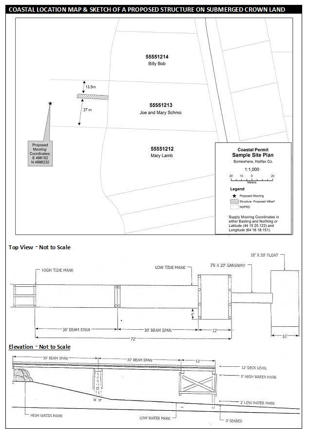
Coastal Location map
- A coastal location map must show:
- The location of the proposed wharf, floating dock, boat ramp or mooring in relation to neighbouring PIDS;
- The location of the proposed wharf, floating dock, boat ramp or mooring in relation to the navigation channel and existing wharves, floating docks, boat ramps or moorings;
- Any shoreline within 100 meters of the proposed wharf, floating dock, boat ramp or mooring(s);
- The identity of owner(s) of neighbouring property and the approximate location of sideline boundaries.
- A Coastal Permit application must also include a sketch of the design of the proposed construction.
- The sketch must include the dimensions of the structure (length, width, height above ordinary high water level) and materials to be used.
This is an example of a map that is required to accompany an application for the use of Crown land for building or repairing a wharf.