
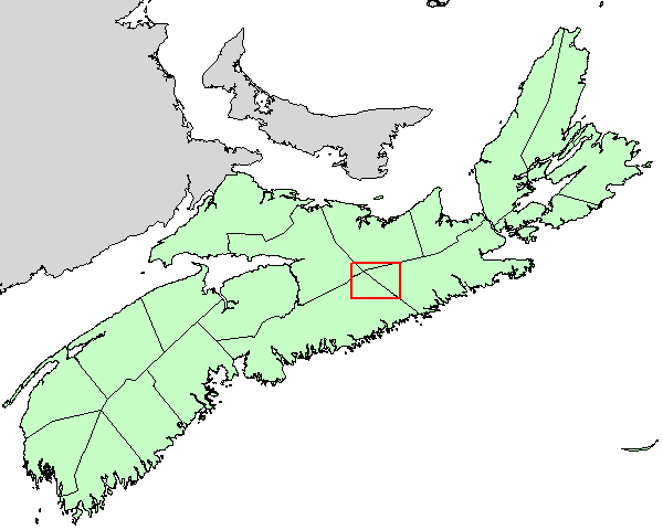
Bedrock Geology Map of the Governor Lake Area, NS
DP ME 442, Version 1, 2011. Digital Version of Nova Scotia Department of Natural Resources Open File Map ME 2011-013, Bedrock Geology Map of the Governor Lake Area, Part of NTS Sheets 11E/01, 11E/02, 11E/07 and 11E/08, Colchester, Guysborough, Halifax, and Pictou Counties, Nova Scotia, Scale 1:50 000, by C. E. White and K. L. Scallion, 2011
Related Products
... DP ME 56
Abstract
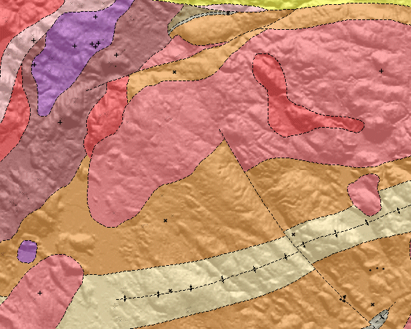
This digital product is a compilation of geological data which was collected as part of Chris White's mapping of the Governor Lake area in 2008. The data was used to create Nova Scotia Department of Natural Resources (NSNR&R) Open File Map OFM ME 2011-013, compiled by C. E. White and K. L. Scallion, 2011. The digital product was created by the NSNR&R, Mineral Resources Branch (MRB) staff. The digital product contains layers for geological features such as: age dates, anticlines and synclines, drillholes, faults, bedrock geology, geological contacts, mining districts, mineral occurrences, neatline, small outcrops, and structural data. In 2008, a detailed (1:10 000 scale) bedrock mapping and sampling project was initiated in the Governor Lake area in Colchester, Guysborough, Halifax and Pictou counties. It includes parts of NTS map sheets 11E/01, 02, 07 and 08 (White et al., 2009). This area was previously included in the 'Liscomb Complex', which was considered to be 'basement' gneissic units with upper amphibolite- to granulite-facies metamorphic assemblages (e.g. Clarke et al., 1993; Kontak and Reynolds, 1994; Dostal et al., 2006; Giles et al., 2008; Owen et al., 2010).
The results of this project do not support this interpretation (White et al., 2009). Units previously identified as gneiss are igneous units with magma-mingling or mylonitic textures. based on structural studies, the igneous units were intruded synchronously with deformation in the host Goldenville and Halifax groups during the Middle Devonian to Early Carboniferous Neoacadian Orogeny. Therefore, the term 'Liscomb Complex' should be abandoned and models for the tectonic evolution of the Meguma Terrane modified accordingly. Geological contacts east of highway 374 are largely based on the extrapolation of mapped units and the use of second vertical derivative aeromagnetic data (King, 1997a, b).
Disclaimer
The DATA is provided to the USER on an "as is" basis, without warranties of any kind, express or implied.
The entire risk as to the quality and accuracy of the DATA is with the USER and the USER shall use his/her own judgment in making use of the DATA or drawing conclusions based upon it.
NR&R shall not be liable to the USER, his/her clients, servants, agents, contractors, assigns, or to any other person for any loss or damage of any kind including personal injury or death arising from the use of the DATA or accompanying written materials, or from errors, deficiencies or faults therein, whether such damage is caused by negligence or otherwise. If errors or omissions are found in the DATA, the USER will notify NR&R.
The terms and conditions of the license accompany the downloaded digital product.
Format
ArcInfo Interchange Format (E00), DXF/DBF, ArcView 3.2a shape files (SHP), ArcInfo File Geodatabase (GDB), and TXT files compressed in self-extracting EXE/ZIP files (more information on data formats)
Size
E00 - 0.5 MB (compressed), 3.1 MB (uncompressed)
DXF/DBF - 0.4 MB (compressed), 3.8 MB (uncompressed)
SHP - 3.6 MB (compressed), 8.6 MB (uncompressed)
GDB - 4.3 MB (compressed), 8 MB (uncompressed)
Projection
The data is in six-degree Universal Transverse Mercator (UTM) projection, Zone 20, Central Meridian 63° 00' West using the North American Datum of 1983 (NAD83).
Downloading Instructions
The data files have been compressed using PKZIP into a single, self-extracting EXE file.
- Read the Licence before accepting the data.
- Download the self-extracting EXE file to the desired location on your hard drive.
- Double click or "RUN" the EXE file and the data files will be unzipped automatically.
The EXE file can also be opened in WinZip to view and extract the compressed files in the data set.
On UNIX platforms, the unzip command will extract the compressed files in the EXE.
All data sets are in six-degree Universal Transverse Mercator (UTM) Zone 20 projection using the NAD83 datum.
A readme file and a copy of the licence agreement are also included with each data set.