Shaded Relief Images of the Cobequid Highlands Area, Nova Scotia
DP ME 479, Version 1, 2012. Shaded Relief Images Derived From a 1 m LiDAR Bare-Earth Digital Elevation Model of the Cobequid Highlands Area, Cumberland, Colchester and Pictou Counties, Nova Scotia, Compiled by B.E. Fisher and J.C. Poole. |
|||||||
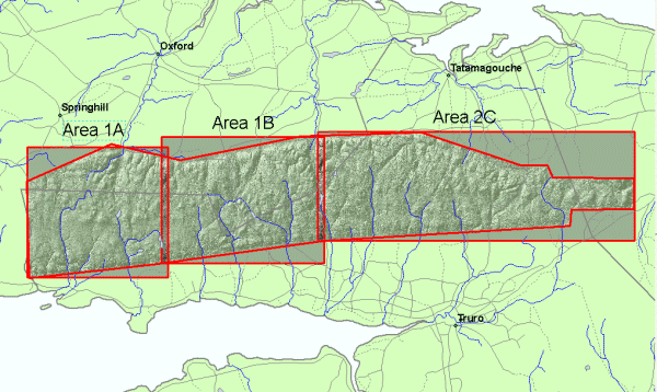
AbstractThis digital product consists of 144 shaded relief images derived from three contiguous LiDAR bare-earth Digital Elevation Models (DEM) of the Cobequid Highlands of Nova Scotia. The DEMs were gridded at 1m cell size from three areas of a survey carried out in December, 2010. Images were processed at 8 shading azimuths (0, 045, 090, 135, 180, 225, 270, 315) and 3 different altitudes (30°, 45°, 60°). The images were produced with two different vertical exaggerations (5 and 10). The digital product was created by the Nova Scotia Department of Natural
Resources, Mineral Resources Branch (MRB) staff. Funding for this product was provided by the Government of Canada, Natural
Resources Canada under the Methodology Developments Project of the Targeted
Geoscience Program 4 (TGI-4). The Cobequid Highland LiDAR survey is a
collaborative project between the Geological Survey of Canada and the
Nova Scotia Department of Natural Resources. |
|||||||
DisclaimerThe DATA is provided to the USER on an "as is" basis, without warranties of any kind, express or implied. The entire risk as to the quality and accuracy of the DATA is with the USER and the USER shall use his/her own judgment in making use of the DATA or drawing conclusions based upon it. NR&R shall not be liable to the USER, his/her clients, servants, agents, contractors, assigns, or to any other person for any loss or damage of any kind including personal injury or death arising from the use of the DATA or accompanying written materials, or from errors, deficiencies or faults therein, whether such damage is caused by negligence or otherwise. If errors or omissions are found in the DATA, the USER will notify NR&R. The terms and conditions of the license accompany the downloaded digital product. |
|||||||
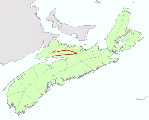
General Location Map
|
|||||||
Project Location Map
|
|||||||
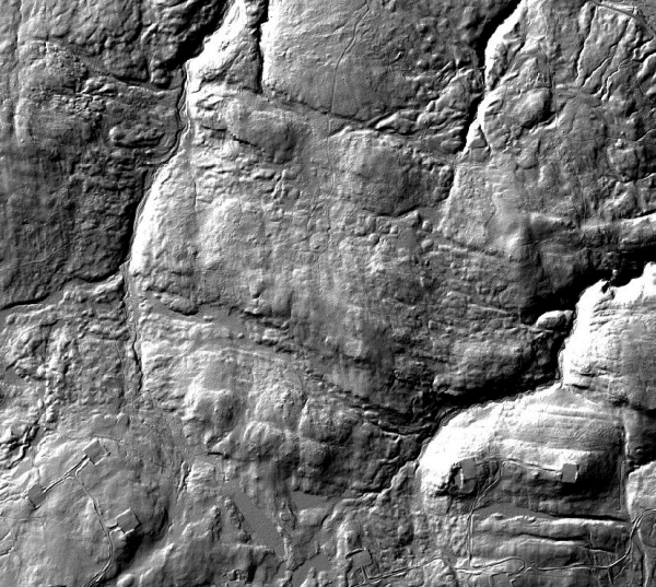
Detailed View
Note the ~E-W trending basalt lava flows of the Diamond Brook Formation in the top part of this image along with the square wind farm platforms, with connecting road network, in the lower part of the image. For other examples see the following poster from Geology Matters 2011 ... PDF Link. |
|||||||
Format and Projection
|
|||||||
Downloading InstructionsThe data files have been compressed using PKZIP into a single, self-extracting EXE file.
The EXE file can also be opened in WinZip to view and extract the compressed files in the data set. On UNIX platforms, the unzip command will extract the compressed files in the EXE. All data sets are in six-degree Universal Transverse Mercator (UTM) Zone 20 projection using the NAD83 datum. A readme file and a copy of the licence agreement are also included with each data set. |
|||||||
|
|
|||||||