

 Liscomb River Wilderness Area, in western Guysborough County, protects much of one of Nova Scotia’s preeminent wild rivers. It includes corridors along Liscomb River and its main tributary, Little Liscomb River, as well as a large patch of remote woodland east of the lower Liscomb River.
Together with Alder Ground Wilderness Area, Liscomb River Wilderness Area protects more than 40 km of contiguous river corridor, from the Eastern Shore interior to just north of Highway 7 and the Atlantic Ocean at Liscombe Lodge. One road crossing interrupts this corridor at Camp Lake.
The protected woodlands and extensive wetlands and barrens help protect water quality and habitat for brook trout, a small Atlantic salmon run and many other species. Wildlife can use the protected corridor to move between the interior and coastal regions of the Eastern Shore. Beaver, muskrat, otter, weasel, mink and endangered mainland moose may be found here.
The forests consist primarily of mature and regenerating softwood forest. Hardwood forest occurs where soils are best, such as on scattered drumlins. The large patch of remote woodland east of the river is characterized by a mosaic of low, broad deciduous hills and ridges, coniferous flats, bedrock ridges and barrens, hummocky terrain, and wetlands of all sizes.
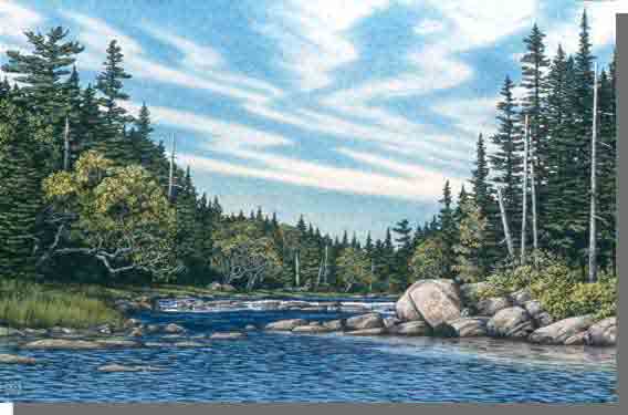
This wilderness area helps conserve the Liscomb River system as an angling and backcountry canoe destination. Multi-day canoe-tripping excursions are best attempted at high water. The river offers a mix of flat stillwaters, easy rips and turbulent rapids. Traditional access points include:
- Big Liscomb Lake and Island Lake, upstream of the wilderness area, off private forestry roads
- the bridge on Liscomb River Road at Camp Lake, on provincial land
- an old trail into Big Stillwater near the fish ladder, on provincial land
Options include exploring the river to where it meets the Atlantic Ocean near Liscombe Lodge, or more local excursions, such as on Big Stillwater. The adventurous might consider connecting through Boggy Lake Wilderness Area to Moser River, following the traditional warden route. Detailed canoeing maps for Liscomb River are available at many outdoor stores. Road information on these maps may be dated and portages are generally not maintained.
Several campsite leases occur within the wilderness area.
Wilderness area designation of an additional 102 hectares at First Lake, on Joe Brook, will take effect if overlapped mineral rights expire and no new rights are granted.
The southern boundary of the wilderness area extends nearly to Highway 7, across the road from Liscombe Lodge. The Lodge maintains a hiking trail along the river in this part of the wilderness area.
Initially designated in 1998, the wilderness area was expanded in 2015, more than doubling its size to over 6,300 hectares. An additional 144 ha area near Highway 7 and Liscombe Lodge was added in 2023.