Nova Scotia Archives
Mi'kmaq Holdings Resource Guide
Items regarding land in Nova Scotia that is not included within the Crown Reservations
note: transcription publicly contributed - please contact us with comments, errors or omisions
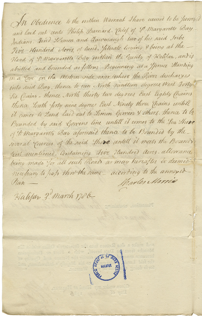
In Obedience to the within Warrant I have caused to be surveyed and laid out unto Philip Barnard. Chief of St. Margaretts Bay Indians, and Solomon and Tawmaugh two of his said tribe Five Hundred Acres of land. Situate laying & being at the Head of St. Margaretts Bay within the County of Halifax, and is abutted and bounded as follows - Beginning at a Spruce Standing in a Cove on the Western side near where the River discharges into said Bay, thence to run North nineteen degrees West Forty Six Chains- thence North thirty two degrees East Eighty Chains thence South forty nine degrees east Ninety three Chains untill it comes to Land laid out to Simon Gorren & others. thence to be Bounded by said Gorrens line untill it comes to the Sea Shore of St. Margaretts Bay aforesaid thence to be Bounded by the several cources of the said Shore untill it meets the Bound first mentioned, containing Five Hundred Acres. allowance being made for all such Roads as may hereafter be deemed necessary to pass thru the same -- according to the annexed Plan --
Charles Morris
Halifax 3d. March 1786

Requested by Mi'kmaq Chief Philip Bernard including Warrant to the Chief Surveyor of Lands Charles Morris to measure and lay out 500 acres at St. Margaret's Bay, with Morris' reply, and original memorial from Bernard. Also, a memorial from Solomon Jeremiah, Michael Jeremiah, Joseph Glod and others regarding land upon which to settle.
Retrieval no.: Commissioner of Public Records — Mi'kmaq and Government Relations series Nova Scotia Archives RG 1 volume 430 number 26 1/2