Nova Scotia Archives
African Nova Scotian Diaspora
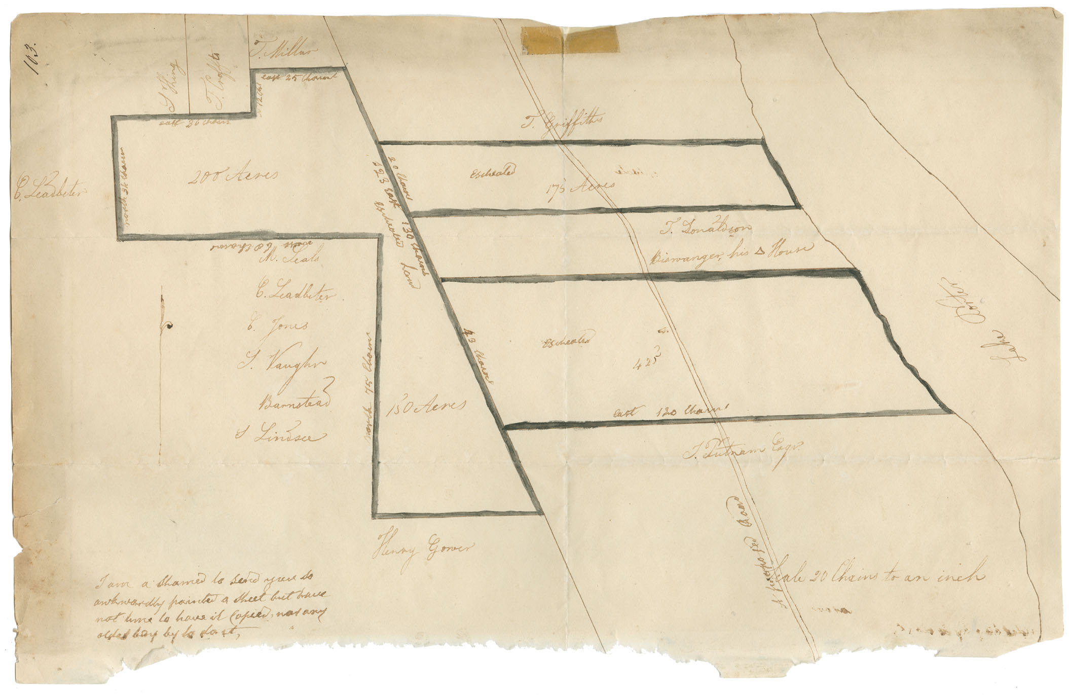
Plan of certain lands at Lake Porter (without signature or date)
note: transcription publicly contributed - please contact us with comments, errors or omisions
[Transcriber's note: this iss a surveyor's plan, not possible to represent without special formatting tools. The transcriptions here are therefore only of the words on the paper. I have typed them in a list, but the list follows roughly the order of the names and the surveyor's notations as they appear from left to right, moving from top to bottom of the sheet of paper.]
103
S Hing
T. Crofts
T. Millar
east 25 chains
C. Leadbeter
east 30 chains
N. 12 ch's
T. Griffiths
north [34?] chains
200 Acres
[s?] 23 east 130 chains
20 chains
Escheated
175 Acres
West 60 Chains [transcriber's note: upside down text]
Escheated Land
T. Donaldson
Biawanger, his [triangle mark] House
M. Seals
C. Leadbeter
C. Jones
S. Vaughn
Barnstead
43 Chains
North 75 Chains
Escheated
425'
S Lindsee
east 120 Chains
T. Putnam Esqr.
Lake Porter
Henry Gower
A proposed Road
Scale 20 Chains to an inch
I am a Shamed to send you so awkwardly painted a Sheet but have not time to have it Copied, nor any older boy by to do it, [transcriber's note: this note may be T. Chamberlain's handwriting, ditto the measurements -- i.e. numbers of chains -- on the plan. The other handwriting would therefore appear to be added separately, probably later. ]
")
Reference: Commissioner of Public Records collection Nova Scotia Archives RG 1 volume 419 number 103