Nova Scotia Archives
Mi'kmaq Holdings Resource Guide
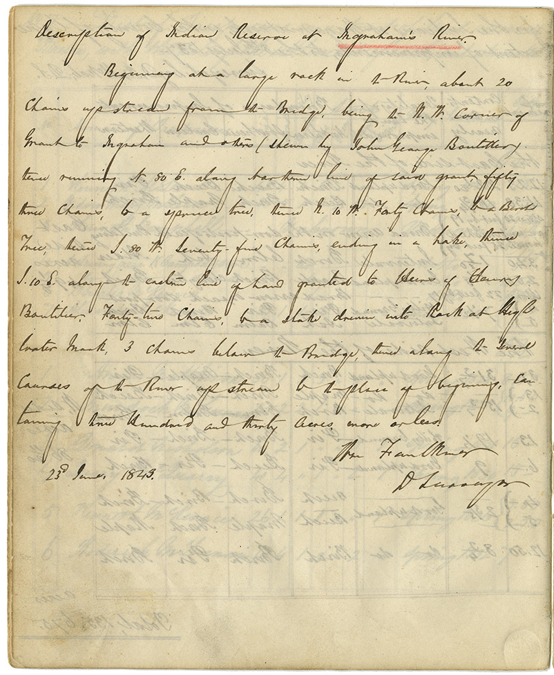
Report of William Faulkner, Deputy Surveyor, describing the Mi'kmaq reserve at Ingram River. Includes map of 330 acres of reserve.
note: transcription publicly contributed - please contact us with comments, errors or omisions
Description of Indian Reserve at Ingraham's River.
Beginning on a large rock in the River, about 20 Chains upstream from the Bridge, being the N. W. Corner of Grant to Ingraham and others (shown by John George Boutilier) then running N 80. E along northern line of said grant, fifty three chains, to a spruce tree, thence N. 10 W. Forty Chains, to a Birch Tree, thence S. 80 W. Seventy-five Chains, ending in a Lake, thence S. 10 E. along the eastern line of land granted to Heirs of Henry Boutilier, Forty-two Chains, to a stake driven into Rock at High Water Mark, 3 chains below the Bridge, thence along the usual courses of the River up stream to the place of beginning, containing three Hundred and thirty acres, more or less.
Wm Faulkner
D. Surveyor
23rd June, 1843.

Date: 1843
Retrieval no.: Commissioner of Public Records — Mi'kmaq and Government Relations series Nova Scotia Archives RG 1 volume 432 pp. 214-215