
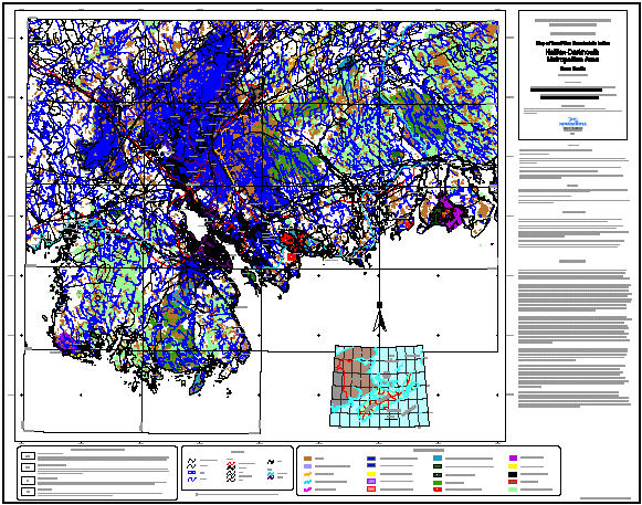
Map of Land Use Constraints in the Halifax-Dartmouth Metropolitan Area, Nova Scotia
DP ME 49, Version 1, 2003, Digital Version of Nova Scotia Department of Natural Resources, Open File Map ME 2001-2, Map of Land Use Constraints in the Halifax-Dartmouth Metropolitan Area, Nova Scotia, Scale 1:100 000, compiled by Garth Prime, 2001.
Abstract
Land use issues are an integral component in the determination of aggregate resource potential in an urban setting. A variety of legislative regulations, zoning restrictions and land use designations, imposed by all levels of government, affect where and how aggregate quarries can operate. The best aggregate deposit in the region may be impossible to develop if a conflicting land use overlies or occurs in proximity to the site.
This map is a compilation of land use constraints that may have an impact on aggregate resource development in the Metro area. It accompanies the Economic Geology Series ME 2001-1, Overview of Bedrock Aggregate Potential in the Halifax-Dartmouth Metropolitan Area, Nova Scotia, by G. Prime. The purpose of this map is to help narrow the search when looking for a quarry site.
Disclaimer
The DATA is provided to the USER on an "as is" basis, without warranties of any kind, express or implied. The entire risk as to the quality and accuracy of the DATA is with the USER and the USER shall use his/her own judgment in making use of the DATA or drawing conclusions based upon it. NR&R shall not be liable to the USER, his/her clients, servants, agents, contractors, assigns, or to any other person for any loss or damage of any kind including personal injury or death arising from the use of the DATA or accompanying written materials, or from errors, deficiencies or faults therein, whether such damage is caused by negligence or otherwise. If errors or omissions are found in the DATA, the USER will notify NR&R. The terms and conditions of the license accompany the downloaded digital product.
Format
Portable Document Format (PDF) and TXT files compressed in self-extracting EXE/ZIP files (more information on data formats)
Size
PDF - 4.5 MB
Projection
The data is in six-degree Universal Transverse Mercator (UTM) projection, Zone 20, Central Meridian 63° 00' West using the North American Datum of 1927 (NAD27).
Downloading Instructions
The data files have been compressed using PKZIP into a single, self-extracting EXE file.
- Read the Licence before accepting the data.
- Download the self-extracting EXE file to the desired location on your hard drive.
- Double click or "RUN" the EXE file and the data files will be unzipped automatically.
The EXE file can also be opened in WinZip to view and extract the compressed files in the data set.
On UNIX platforms, the unzip command will extract the compressed files in the EXE.
All data sets are in six-degree Universal Transverse Mercator (UTM) Zone 20 projection using the NAD27 datum. A readme file and a copy of the licence agreement are also included with each data set.