
VLF-EM Images for South-central Cape Breton Island, Nova Scotia
DP ME 64, Version 2, 2006. Airborne VLF-EM Total Field and Quadrature Images for NTS Sheets 11F/14, 11K/02 and 11K/03, Part of the TGI Project Area, South-central Cape Breton Island, Nova Scotia
Abstract
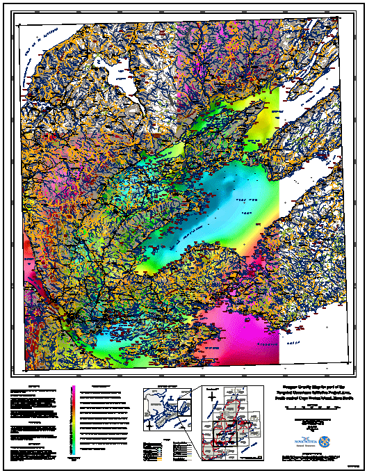
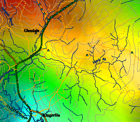
This digital product contains two images for total field and quadrature VLF-EM map images which were derived from data collected by the Geological Survey of Canada (Survey# 260). The levelled and de-corrugated Line (Tx: Annapolis, Md) and Ortho (Tx. Cutler, Me) data were summed to increase the signal to noise ratio of the measured quadrature values. VLF-EM data is significantly biased by the orientation of the transmitted with respect to the survey area; in this case both Line and Ortho stations are essentially parallel (~220 degrees) and generate similar electromagnetic coupling patterns with structural and stratigraphic trends in the project area. Quadrature VLF-EM response provides a measure of the electrical current gathering (channelling) at linear interfaces such as stratigraphic contacts and/or faults and fractures. The 24-bit colour map images were produced with a 20m pixel size. Shading was from the southeast at 35 degrees above the horizon. For complete details please refer to Open File Report ME 2033-3 by King.
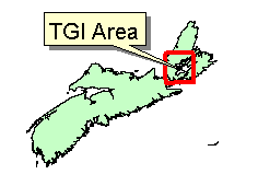
Contribution to the Natural Resources Canada and Nova Scotia Department of Natural Resources joint project 'Geological Mapping and Mineral Development, South-central Cape Breton Island', part of Natural Resources Canada's Targeted Geoscience Initiative (TGI) 2000-2003.
Disclaimer
The information on the PDF map comes from a variety of government and non-government sources. NSNR&R accepts no liability for any errors or deficiencies on this map. This map should not be used for legal purposes.
The PDF map is intended for use at the published scale of 1:50 000.
The DATA is provided to the USER on an "as is" basis, without warranties of any kind, express or implied. The entire risk as to the quality and accuracy of the DATA is with the USER and the USER shall use his/her own judgment in making use of the DATA or drawing conclusions based upon it. NR&R shall not be liable to the USER, his/her clients, servants, agents, contractors, assigns, or to any other person for any loss or damage of any kind including personal injury or death arising from the use of the DATA or accompanying written materials, or from errors, deficiencies or faults therein, whether such damage is caused by negligence or otherwise. If errors or omissions are found in the DATA, the USER will notify NR&R. The terms and conditions of the license accompany the downloaded digital product.
Format
Portable Document Format (PDF), Tag Image File Format (TIFF), Joint Photographic Experts Group (JPEG) and TXT files compressed in self-extracting EXE/ZIP files (more information on data formats)
Size
PDF - 2.3 to 21.6 MB (compressed and uncompressed)
TIFF - 11.4 MB (compressed), 37.9 MB (uncompressed)
JPEG - 3.0 MB (compressed), 3.1 MB (uncompressed)
Projection
The TIFF and JPEG images are in six-degree Universal Transverse Mercator (UTM) projection, Zone 20, Central Meridian 63° 00' West using the North American Datum of 1983 (NAD83).
The PDF maps are are in six-degree Universal Transverse Mercator (UTM) projection, Zone 20, Central Meridian 63° 00' West using the North American Datum of 1983 (NAD83).
Downloading Instructions
The data files have been compressed using PKZIP into a single, self-extracting EXE file.
- Read the Licence before accepting the data.
- Download the self-extracting EXE file to the desired location on your hard drive.
- Double click or "RUN" the EXE file and the data files will be unzipped automatically.
The EXE file can also be opened in WinZip to view and extract the compressed files in the data set.
On UNIX platforms, the unzip command will extract the compressed files in the EXE.
All data sets are in six-degree Universal Transverse Mercator (UTM) Zone 20 projection using the NAD83 datum. A readme file and a copy of the licence agreement are also included with each data set.