|
|
| Government Home > Natural Resources > Hurricane Juan > Preliminary Asssesment | |
| |
|
| Topics View Map Service Damage to Woodlands Damage to Provincial Parks Download Imagery Contact Us |
Hurricane
Juan Preliminary Assessment
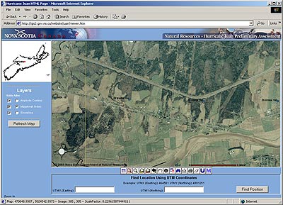
This map service is intended to provide landowners access to an image database that depicts the forest condition after Hurricane Juan hit the province September 29, 2003. Digital orthophotography was used to create the image mosaics. The aerial photography used was flown in October and November 2003. The popularity of this service has led to slow startup and long
download (refresh) times. Please note that image output can
be quite large and may take a long time to reload depending on available
bandwidth.
|
|
| Disclaimer: The Department of Natural Resources makes no claim as to the accuracy of the data and further stipulates that the user of the data assumes all risks associated with the use of the data. |
The contents of this site
are best viewed with an enhanced browser such as |