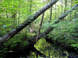
 Devils Jaw Wilderness Area protects two, distinctly different forested areas in the headwaters of Herbert River, between Mount Uniacke and Rawdon.
The smaller of the two parts wraps around the western side of Long Lake and includes about 15 km of scenic lakeshore. The jagged shore, with nine islands, is formed by quartzite ridges that extend throughout the site, creating alternating bands of narrow wetland and forest. Much of the forest consists of spruce-fir, with tall white pines towering overhead.
The larger part of the wilderness area lies 5 km to the northeast, between Herbert River and Highway 354, just south of the Rawdon Hills. Centred around Bull Meadow Mountain, this area consists of broad hills, flats, ridges and ravines. The varied topography supports many forest types, such as red pine on dry sites, black spruce in wet areas, white ash floodplains, and sugar maple slopes. Old eastern hemlock and tall red spruce occur along humid ravines. Hebert River is a defining feature of this part of the wilderness area. The gently meandering river is interrupted by short stretches of fast water (including at its namesake, Devils Jaw) and small pools. This mix of river conditions provides habitat for wood turtle, a listed species at risk, and attracts bald eagles and osprey. Some of the land along the river was acquired by the Nova Scotia Nature Trust and transferred to the Province for protection.
The mature forests throughout the wilderness area provide important habitat for interior forest species such as northern goshawk. They protect natural “stepping stones” for wildlife movement in what is predominantly a working forest and farm region.
The diversity of protected habitats improves representation of the Central Quartzite Hills and Plains natural landscape in the provincial protected areas network.
Devils Jaw Wilderness Area is an important outdoor backcountry recreation destination, located close to major populations in Hants and Hants counties. Its varied and rugged terrain, exceptional lake and river scenery and easy access provide quality opportunities for paddling, angling, hunting, camping and other wilderness adventure. Currently, no managed hiking trails exist here.
The rough road to the boat launch site at Lawrence Cove is not within the wilderness area, allowing ongoing vehicle access to Long Lake.
The wilderness area includes one campsite lease at Long Lake.
At the larger part of the wilderness area, the Nova Scotia Rifle Association (NSRA) holds a lease with Department of Natural Resources and Renewables (NRR) for its Bull Meadow Range Complex. The wilderness area boundary avoids the developed portion of this complex, including access roads. The extensive safety zone is within the wilderness area. NSRA is both authorized and obligated under the lease agreement to post warning signs along the boundary of the lease area to ensure public safety. Nova Scotia Environment and Climate Change (ECC) is honouring NSRA’s lease as it applies to the safety zone and discourages public recreation / access within this zone.
Devils Jaw Wilderness Area was established in 2015. A 40 hectare parcel at Withrow Lake was added in 2023. Wilderness area designation of an additional 225 hectares near Gulf Brook will take effect if overlapping mineral rights expire and no new rights are granted within one year of their expiration.

