

 Rising more than 300m above the tranquil agricultural landscape of the Margaree River valley, Sugarloaf Wilderness Area protects a unique granitic pluton that forms a well-drained deciduous hill ecosystem, which is part of the Interior Steep Slopes landscape.
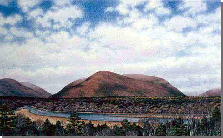
Sugarloaf Mountain represents a small section of the Cape Breton Highlands, cut off and separated by fault-bounded river valleys. The well known, and easily identified landmark forms both a well-defined landform and ecosystem, clearly exhibiting the relationships between the biological and physical elements of the landscape. The large, fault-bounded and prominent rounded hill, with its steep-sided slopes supports a mature climax deciduous forest with a groundcover assemblage dominated by wood fern, beech fern, and wood sorrel.
Sugarloaf Mountain Wilderness Area forms the eastern shore of the Northeast Margaree River, between Portree and Big Intervale. With the current, and increasing, popularity of the Margaree River for fishing and canoeing, the natural backdrop of the Wilderness Area adds considerably to the natural heritage values of the river. The Northeast Margaree River is part of the Margaree-Lake Ainslie Canadian Heritage River.
Intrepid day hikers may discover a spectacular view of the lower Margaree Valley from atop the mountain's south slope, and efforts are underway by the community to develop a scenic hiking trail to this location.