Geological Mapping of Southwestern Nova Scotia
DP ME 127, Version 1, 2012. Digital Geological Data Generated as Part of Geological Mapping of the Meguma Terrane of Southwestern Nova Scotia (1998-2010), Shelburne, Digby, Yarmouth, Annapolis, Queens, and Lunenburg Counties, Nova Scotia. Digital product compiled by C. E. White, B. E. Fisher, J. S. McKinnon and A. L. Ehler. |
|||||||
|
Related Products Map Viewers |
AbstractThis digital product is a compilation of geological data which was collected as part of the mapping of the Meguma Terrane of southwestern Nova Scotia by C.E. White. The principal goals of this project are to produce a series of 1:50 000 scale geological bedrock maps of the area, to describe and interpret the sedimentary, igneous, metamorphic and deformational history of the Cambrian to Early Devonian metamorphic rocks, and to evaluate the area’s economic potential. The data was used to create Nova Scotia Department of Natural Resources (NSNR&R) Open File Maps OFM ME 2012-076 to 2012-101, compiled by C. E. White, 2012. The digital product was created by the NSNR&R, Mineral Resources Branch (MRB) staff. The original digital data was compiled from a number of sources and supplemented by field done during the course of the project. The digital product contains layers for geological features such as: age dates, anticlines/synclines, areas of concentrated drilling, drillholes, dykes, faults, fossils, bedrock geologic units, geological contacts, gold districts, mines, mineral occurrences, small outcrops, quarries, shafts, stockworks, structural data, and shear zones. |
||||||
DisclaimerThe DATA is provided to the USER on an "as is" basis, without warranties of any kind, express or implied. The entire risk as to the quality and accuracy of the DATA is with the USER and the USER shall use his/her own judgment in making use of the DATA or drawing conclusions based upon it. NR&R shall not be liable to the USER, his/her clients, servants, agents, contractors, assigns, or to any other person for any loss or damage of any kind including personal injury or death arising from the use of the DATA or accompanying written materials, or from errors, deficiencies or faults therein, whether such damage is caused by negligence or otherwise. If errors or omissions are found in the DATA, the USER will notify NR&R. The terms and conditions of the license accompany the downloaded digital product. |
|||||||
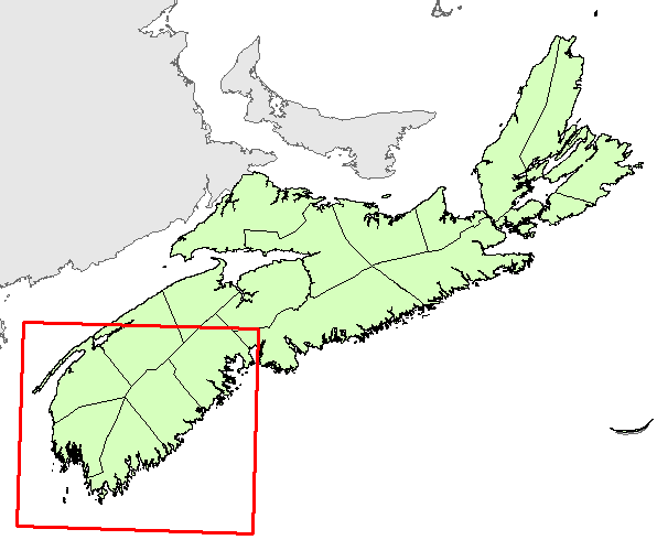
Location Map
|
|||||||
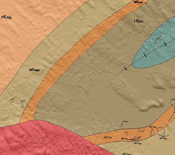
Detailed View
|
|||||||
Format and Projection
|
|||||||
Downloading InstructionsThe data files have been compressed using PKZIP into a single, self-extracting EXE file.
The EXE file can also be opened in WinZip to view and extract the compressed files in the data set. On UNIX platforms, the unzip command will extract the compressed files in the EXE. All data sets are in six-degree Universal Transverse Mercator (UTM) Zone 20 projection using the NAD83 datum. A readme file and a copy of the licence agreement are also included with each data set. |
|||||||
|
|
|||||||