
Forest Vegetation types - WD8
WD8 — Red spruce – Red maple /Wood sorrel – Sensitive fern / Sphagnum
Picea rubens – Acer rubrum / Oxalis acetosella – Onoclea sensibilis / Sphagnum spp.
 |
Tyndal Road, Cumberland County |
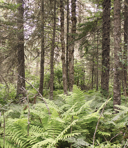
Concept: This ecosystem is one of three wet mixedwood forests in Nova Scotia. These Vegetation Types (VTs) are mostly distinguished by major differences in canopy composition and more minor differences in soil fertility and understory composition. This mature closed canopy forest ecosystem is characterized by red spruce and red maple co-dominance, moderate to high herbaceous cover and a well-developed sphagnum moss layer. It usually occurs on moist to wet mineral soils where it may persist as a type of edaphic climax.
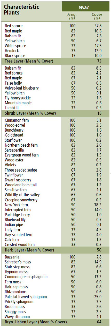
Vegetation: The closed canopy is co-dominated by red spruce and red maple, with lesser balsam fir. Low to moderate cover is typical in the woody understory, where regenerating trees and false holly are characteristic. The well-developed herbaceous layer includes frequent cinnamon fern, wood sorrel, northern beech fern, wood aster, three seeded sedge, dwarf raspberry and sensitive fern, among other common upland plants. Bryophyte development is moderate, composed of sphagnum and lesser amounts of common upland moss and liverwort species.
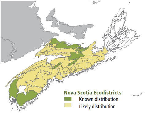
Environmental Setting: This low elevation forest occurs on moist to wet sites. Most soils are poorly drained glacial tills of varying texture, with limited ground and/or surface water inputs, and only intermediate nutrient availability. Flats, shallow depressions and gentle slopes with moderate micro-topography are typical sites. Aspect is variable. Most occurrences are in the Nova Scotia Uplands and Western ecoregions. WD8 is uncommon on Prince Edward Island but widespread and abundant across south and central New Brunswick.
Successional Dynamics: This ecosystem can be expressed at a variety of successional stages, but most stands are mid-successional. It is maintained by limiting site conditions and typically small- to intermediate-scaled disturbances (e.g. tree mortality, windthrow and timber harvest events). Wet soils generally limit the potential for successional development, but depending on the ecological context and disturbance regime, WD8 could either maintain itself or transition to WC5 (Red spruce – Balsam fir/ Cinnamon fern / Sphagnum) or WC8 (Hemlock / Cinnamon fern – Sensitive fern / Sphagnum). Transition to WD3 (Red maple / Sensitive fern – Lady fern / Sphagnum) is also possible on richer sites. Stand-level disturbances are uncommon, but windthrow and timber harvest are possible mechanisms of renewal. Tree mortality through senescence can promote uneven-aged stands.
Ecological Features: This small patch forest often forms a transition between open wetland and upland forest, providing distinct if not important landscape functions. Mixedwood forests may support wildlife species associated with both coniferous and deciduous ecosystems. Wildlife that make use of either hardwood or softwood structures will often seek small clumps of target canopy trees within broader matrices of different species. In WD8, hardwood canopy components are often associated with past disturbance events or areas with increased surface and/or subsurface water. Sites are at least slightly mounded, providing increased microhabitat variability. The Red spruce – Red maple / Wood sorrel – Sensitive fern / Sphagnum is a moderately productive mixedwood forest, with a well-developed canopy and often dense herbaceous and bryophyte layers. These forests may develop long-term continuity and an old growth character.
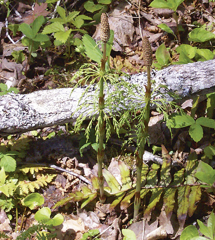 |
| Woodland horsetail |
Distinguishing Features: Red maple and red spruce in the overstory layer define this wet mixedwood forest. False holly, cinnamon fern, three seeded sedge, dwarf raspberry and sensitive fern are good indicators of this vegetation type.
| Slope Position: | Level3 Lower3 Depression2 Toe2 |
Surface Stoniness: |
(Non - Slightly)8 (Moderately)1 (Very - Excessively)1 |
Bedrock Outcrop: |
(Non-rocky)10 |
Elevation Range: |
13 - 148m |
Slope Gradient: |
Level5 Gentle5 |
Aspect: |
North1 East1 South1 West1 None6 |
Exposure: |
Moderate7 Mod. exposed1 Mod. sheltered1 Sheltered1 |
Microtopography: |
Level3 Slightly3 Moderately2 Strongly2 |
Drainage: |
Poor7 Imperfect3 |
Soil Type: |
ST44 ST73 ST102 ST141 |
Parent Material: |
Glacial till7 Organic2 Lacustrine1 |
Rooting Depth (cm): |
(<30)8 (30-45)1 nd1 |
Duff Thickness (cm): |
(11-20)5 (21-40)3 nd2 |
![]()