
DP ME 112
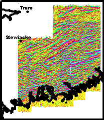
DP ME 112, Version 2, 2006. Airborne VLF-EM Line Total Field Images Collectively Covering NTS Sheets 11D/15, 11E02 and Parts of 11D/10, 11D/11, 11D/14, 11E/03 and 11E/07, Musquodoboit Valley Area, Nova Scotia, by M. S. King, 2004. Available in TIFF and JPEG Format, and also as PDF's of OFM ME 2005-102 to 109.
TIFF and JPEG Image Downloads
Click On Index Map to Download a PDF Map …
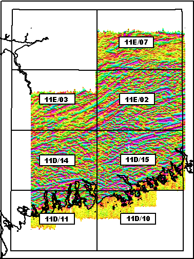
Download VLF-EM Orthogonal Total Field (VTF) PDF Map by Mapsheet …
Download PDF of OFM ME 2005-108, VTF Map for 11E/07 (5.6 MB compressed/ 6.1 MB uncompressed)Download PDF of OFM ME 2005-107, VTF Map for 11E/03 (4.4 MB compressed/ 4.9 MB uncompressed)
Download PDF of OFM ME 2005-106, VTF Map for 11E/02 (7.5 MB compressed/ 8.5 MB uncompressed)
Download PDF of OFM ME 2005-104, VTF Map for 11D/14 (6.8 MB compressed/ 7.5 MB uncompressed)
Download PDF of OFM ME 2005-105, VTF Map for 11D/15 (7.6 MB compressed/ 8.5 MB uncompressed)
Download PDF of OFM ME 2005-103, VTF Map for 11D/11 (3.1 MB compressed/ 3.5 MB uncompressed)
Download PDF of OFM ME 2005-102, VTF Map for 11D/10 (1.4 MB compressed/ 1.6 MB uncompressed)
VLF-EM Line Total Field (VTF) PDF Map for the Musquodoboit River Valley Area
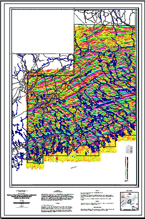
TIFF and JPEG Downloads
| Image Resolution | TIFF | JPEG |
50m |

Click to view detailed image Download VTF TIFF/Legend (50m) (2.8 MB compressed/ 7.8 MB uncompressed) |
Click to view detailed image Download VTF JPEG/Legend (50m) (0.8 MB compressed/ 0.8 MB uncompressed) |
25m |
Click to view detailed image Download VTF TIFF/Legend (25m) (8.5 MB compressed/ 31.0 MB uncompressed) |
Click to view detailed image Download VTF JPEG/Legend (25m) (2.2 MB compressed/ 2.2 MB uncompressed) |