Site Sections
Residents
Visitors
Businesses
Government
News
Search
You are here:
Department of Natural Resources and Renewables
›
Geoscience & Mines Branch
›
DP ME 374
Natural Resources
Navigation
Navigation
Department of Natural Resources
Geoscience & Mines Branch
Maps, Reports & Data
Maps
Reports
Data
Information Services
Department of Lands and Forestry Library
Core Library
Consult Staff
Mineral Resources
Mineral Resources Development Fund
Exploration
Mining
Mineral Occurrences
Warwick Mountain Project
Water Resources
Groundwater
Surface Water
Drinking Water
Geoheritage Resources
Geoheritage in Nova Scotia
Geotourism
Virtual Tour
Sites
Environmental Geology and Land Use
Geohazards
Coastal Flooding and Erosion
Abandoned Mines
Coal Mine Subsidence
Land-use Planning
Education
Mining Cycle
Minerals in our lives
Prospectors Education Program
Virtual Tour
Did You Know?
Registry
NovaROC
Overview
Statutes
Guidelines
Forms
Approvals Required
Links
NovaRoc
Consultation
Communities
Non-Government Organizations
Aboriginal Consultation
One Window Process
Environmental Assessment
About Us
Contact Us
Links
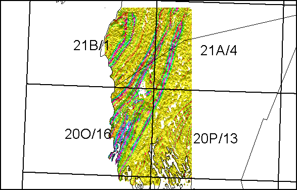
DP ME 374
DP ME 374, Version 1, 2006. Enhanced Aeromagnetic and Digital Elevation Image of the Yarmouth - Cape St. Marys Area Collectively Covering Parts of NTS Map Sheets 20O/16, 20P/13, 21A/04 and 21B/01, (10 m x 10 m Resolution) TIFF Download
Download Aeromagnetic & Digital Elevation Image
(14.1 MB compressed/ 44.1 MB uncompressed)