
Historical Gold Mining Areas in Nova Scotia Map Series
OFM ME 2009-001: Historical Gold Mining Areas in Nova Scotia Map Series (64 Sheets) [Scales 1:1000 to 1:10 000]
 PDF Downloads
Sheet 1, Carleton Area, Yarmouth County, 1:2000, 6.3 MB
Sheet 2, Chegoggin Area, Yarmouth County, 1:6500, 12.9 MB
Sheet 3, Cranberry Head Area, Yarmouth County, 1:4500, 4.2 MB
Sheet 4, Kemptville Area, Yarmouth County, 1:2000, 4.9 MB
Sheet 5, Brookfield Area, Queens County, 1:4500, 14.3 MB
Sheet 6, Fifteen Mile Brook Area, Queens County, 1:1000, 5 MB
Sheet 7, Molega Area, Queens County, 1:4500, 9.5 MB
Sheet 8, Pleasant River Barrens Area, Lunenburg County, 1:6000, 21.8 MB
Sheet 9, Stanburn Area, Lunenburg County, 1:1500, 9.8 MB
Sheet 10, West Caledonia Area, Queens County, 1:6500, 12 MB
Sheet 11, Whiteburn Area, Queens County, 1:6000, 12.4 MB
Sheet 12, Blockhouse Area, Lunenburg County, 1:5000, 7.4 MB
Sheet 13, Gold River Area, Lunenburg County, 1:5000, 9.9 MB
Sheet 14, Leipsigate Area, Lunenburg County, 1:8500, 12.5 MB
Sheet 15, Mill Village Area, Queens County, 1:3000, 6.7 MB
Sheet 16, The Ovens Area, Lunenburg County, 1:2500, 12.4 MB
Sheet 17, Voglers Cove Area, Lunenburg County, 1:5500, 24.2 MB
Sheet 18, Ardoise Area, Hants County, 1:2000, 3.7 MB
Sheet 19, Central Rawdon Area, Hants County, 1:7000, 10.2 MB
Sheet 20, Chezzetcook Area, Halifax County, 1:3000, 11.9 MB
Sheet 21, Cow Bay Area, Halifax County, 1:7000, 11.6 MB
Sheet 22, East Rawdon Area, Hants County, 1:2000, 3.8 MB
Sheet 23, Elmsdale Area, Halifax County, 1:1500, 7.9 MB
Sheet 24, Gays River Area, Colchester and Halifax Counties, 1:10 000, 23.2 MB
Sheet 25, Lake Catcha Area, Halifax County, 1:3500, 10.5 MB
Sheet 26, Lawrencetown Area, Halifax County, 1:9000, 20.2 MB
Sheet 27, McKay Settlement Area, Hants County, 1:2000, 3.2 MB
Sheet 28, Montague Area, Halifax County, 1:4500, 10.6 MB
Sheet 29, Mount Uniacke Area, Hants County, 1:4500, 7.3 MB
Sheet 30, Oldham Area, Halifax County, 1:7000, 13.6 MB
Sheet 31, Renfrew Area, Hants County, 1:6000, 12.2 MB
Sheet 32, South Uniacke Area, Halifax and Hants Counties, 1:4000, 5.8 MB
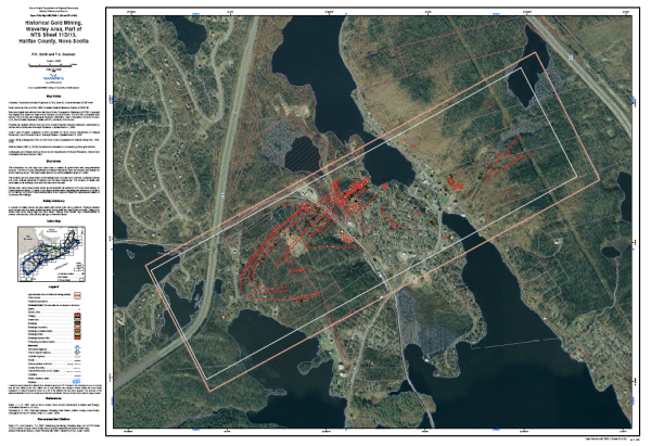
Sheet 33, Waverley Area, Halifax County, 1:4500, 17.1 MB
Sheet 34, West Gore Area, Hants County, 1:4500, 18.1 MB
Sheet 35, Beaver Dam Area, Halifax County, 1:9000, 22.3 MB
Sheet 36, Caribou Area, Halifax County, 1:10 000, 14.1 MB
Sheet 37, Clam Harbour Area, Halifax County, 1:1500, 8.3 MB
Sheet 38, Ecum Secum Area, Halifax County, 1:1500, 6.1 MB
Sheet 39, Fifteen Mile Stream Area, Halifax and Guysborough Counties, 1:9000, 17.5 MB
Sheet 40, Gold Lake Area, Halifax County, 1:8000, 13.5 MB
Sheet 41, Harrigan Cove Area, Halifax County, 1:5000, 8.9 MB
Sheet 42, Killag Area, Halifax County, 1:7500, 8.9 MB
Sheet 43, Lake Charlotte Area, Halifax County, 1:4500, 11.5 MB
Sheet 44, Little Liscomb Lake Area, Guysborough County, 1:1500, 3 MB
Sheet 45, Lochaber Area, Halifax County, 1:5000, 20.4 MB
Sheet 46, Miller Lake Area, Guysborough County, 1:5500, 12 MB
Sheet 47, Moosehead Area, Halifax County, 1:1500, 5.8 MB
Sheet 48, Mooseland Area, Halifax County, 1:7000, 9.9 MB
Sheet 49, Moose River Area, Halifax County, 1:9500, 15.3 MB
Sheet 50, Quoddy Area, Halifax County, 1:2000, 12.8 MB
Sheet 51, Dufferin Mines (Salmon River) Area, Halifax County, 1:3500, 5.1 MB
Sheet 52, Sheet Harbour Area, Halifax County, 1:8000, 12.6 MB
Sheet 53, Ship Harbour Area, Halifax County, 1:2000, 4.2 MB
Sheet 54, Tangier Area, Halifax County, 1:4500, 10.5 MB
Sheet 55, Upper Stewiacke Area, Colchester and Halifax Counties, 1:3000, 5.4 MB
Sheet 56, Lower Caledonia Area, Guysborough County, 1:2500, 9 MB
Sheet 57, Cochrane Hill Area, Guysborough County, 1:5500, 11.4 MB
Sheet 58, Country Harbour Area, Guysborough County, 1:5000, 10.9 MB
Sheet 59, Forest Hill Area, Guysborough County, 1:6000, 9.9 MB
Sheet 60, Goldenville Area, Guysborough County, 1:4500, 7.2 MB
Sheet 61, Isaacs Harbour Area, Guysborough County, 1:6500, 5.1 MB
Sheet 62, Lower Seal Harbour Area, Guysborough County, 1:4000, 7.8 MB
Sheet 63, Upper Seal Harbour Area, Guysborough County, 1:8500, 7.1 MB
Sheet 64, Wine Harbour Area, Guysborough County, 1:5000, 11.2 MB