Coastal Flooding
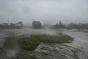
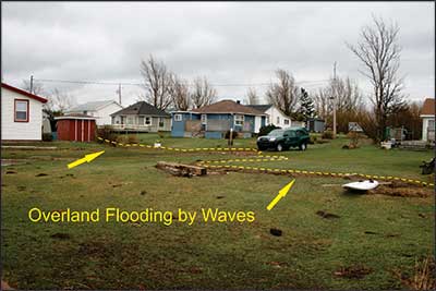
Coastal flooding occurs during severe storms, such as hurricanes and Nor’easters, when the sea rises above predicted tidal levels and inundates low-lying areas. This rise of the sea during storms is called storm surge, and results primarily from increased wind speeds and swell from distant storms, but also low atmospheric pressure.
The risk of flooding increases significantly when a severe storm occurs during high tide In certain parts of the province, storm surges may be even higher if coincident with river flooding due to heavy rain, rapid snow melt, and/or the sudden release of ice jams. The shape of the coastline, near-shore bathymetry, and changes in storm track also determine the height of the storm surge. Taken together, these factors result in some areas being heavily impacted by a particular storm, while others, as close as the next bay over may experience only minor damage.
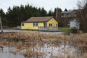
Coastal flooding is only a problem where it intersects with development and people, as coastal zones are naturally dynamic. Flooding in such areas, however, can be very costly and even deadly. The Coastal Erosion and Flooding group of the Minerals Resources Branch are working towards predictive maps, models, and other tools that will help communities and individuals determine their vulnerability to coastal flooding.