
Coastal Risk Assessment
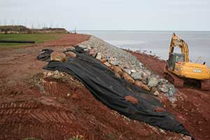
Sea level has been rising along Nova Scotia’s coast for millennia and will continue to rise due to melting of continental ice sheets and ongoing sinking of the land. As a result of these processes, low-lying coastal property and shorefaces are susceptible to flooding and erosion. Rates of erosion along the coast are highly variable, typically ranging from a few tens of centimetres up to as much as a metre or more per year. As a result, a wide variety of coastal stabilization methods are being employed along Nova Scotia’s coastline in efforts to prevent or reduce rates of erosion.
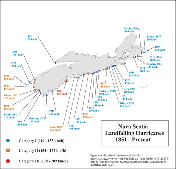
Hurricanes and severe storms that strike near high tide with accompanying storm surges may result in several metres of erosion occurring over only a few hours. Areas where sediment supply to the shoreface has been reduced due to exhaustion of the natural supply (e.g. complete erosion of a drumlin), improper coastal hardening, or where natural barriers to erosion such as sand dunes have been modified, will be the most vulnerable.
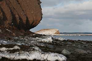
Winter sea ice also plays a role in both protecting the coast and making it more vulnerable to erosion, depending on ice extent and thickness. Regardless of sea ice conditions, sea-level rise and climate change, coastal environments are dynamic systems and erosion is a natural process that plays an important role in their evolution. For example, mud, sand and gravel eroded from cliffs, drumlin headlands, or beaches may be re-deposited onshore, providing material for building beaches elsewhere along the coast. The first step towards developing predictive models of coastal flooding and erosion is to map the geology and geography of our coastline.