
Murphy Oil Company Limited Seismic Data in the Sydney Area
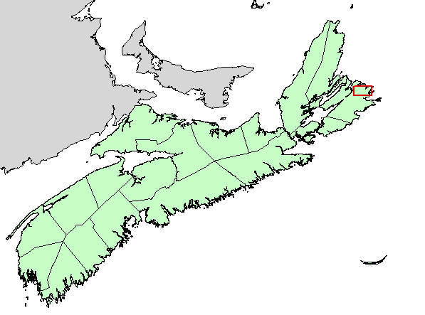
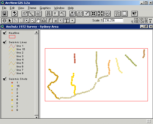
DP ME 94, Version 1, 2006. Digital Seismic Data (Seismic Lines and Shot Locations) from a Seismic Survey by Murphy Oil Company Limited in the Sydney Area, Cape Breton County in 1972 on NTS Sheets 11J/04 and 11K/01
Abstract
This digital product is the Nova Scotia Department of Natural Resources (NSNR&R) digital version of the seismic survey conducted in 1972 by Murphy Oil Company Ltd. in the Sydney area. The digital product was created by the NSNR&R, Mineral Resources Branch (MRB) staff in cooperation with staff from the Department of Energy (DOE) as part of the TGI-2 project. The data was digitized by Nancy Morash (DOE) and provided by DOE to MRB as a shapefile. GIS databases were developed from this data. The digital product contains layers for features such as: seismic lines; location of seismic shots; and a neatline around the survey area.
Disclaimer
The DATA is provided to the USER on an "as is" basis, without warranties of any kind, express or implied. The entire risk as to the quality and accuracy of the DATA is with the USER and the USER shall use his/her own judgment in making use of the DATA or drawing conclusions based upon it. NR&R shall not be liable to the USER, his/her clients, servants, agents, contractors, assigns, or to any other person for any loss or damage of any kind including personal injury or death arising from the use of the DATA or accompanying written materials, or from errors, deficiencies or faults therein, whether such damage is caused by negligence or otherwise. If errors or omissions are found in the DATA, the USER will notify NR&R. The terms and conditions of the license accompany the downloaded digital product.
Format
ArcInfo Interchange Format (E00), DXF/DBF, ArcView 3.2a shape files (SHP) and TXT files compressed in self-extracting EXE/ZIP files (more information on data formats)
Size
E00 - 0.1 MB (compressed), 0.3 MB (uncompressed)
DXF/DBF - 0.1 MB (compressed), 0.4 MB (uncompressed)
SHP - 0.2 MB (compressed), 0.5 MB (uncompressed)
Projection
The data is in six-degree Universal Transverse Mercator (UTM) projection, Zone 20, Central Meridian 63° 00' West using the North American Datum of 1983 (NAD83).
Downloading Instructions
The data files have been compressed using PKZIP into a single, self-extracting EXE file.
- Read the Licence before accepting the data.
- Download the self-extracting EXE file to the desired location on your hard drive.
- Double click or "RUN" the EXE file and the data files will be unzipped automatically.
The EXE file can also be opened in WinZip to view and extract the compressed files in the data set.
On UNIX platforms, the unzip command will extract the compressed files in the EXE.
All data sets are in six-degree Universal Transverse Mercator (UTM) Zone 20 projection using the NAD83 datum. A readme file and a copy of the licence agreement are also included with each data set.