
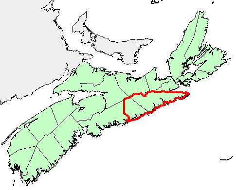
Biogeochemical Survey over the Eastern Meguma Terrane of Nova Scotia
DP ME 129, Version 2, 2006. Biogeochemical Survey by the Nova Scotia Department of Natural Resources Over the Eastern Meguma Terrane of Nova Scotia, 1987
Abstract
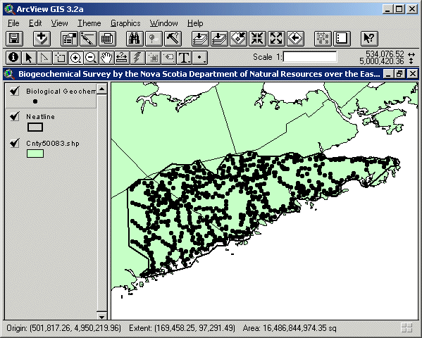
In 1987, a biogeochemical survey was conducted by the Nova Scotia Department of Natural Resources over the Eastern Meguma Terrane of Nova Scotia. Samples were acquired at 2 km intervals along all drivable roads and tracks covering a 5000 km2 area of the eastern Meguma Terrane. A total of 854 locations were visited during a three week period, including detailed sampling at approximately 200 sites over zones of known or suspected mineralization at the Beaver Dam gold deposit. Vegetation sampled included both bark and twigs from balsam fir and red spruce tree species as well as shrub alder twigs.The regional survey of about 600 sites had an average density of 1 per 8.43 km2 and 1 per 46.73 km2 for the balsam fir and red spruce species, respectively. Samples were analyzed for As, Ba, Br, Ca, Co, Cr, Cs, Fe, Hf, K, Mo, Na, Ni, Rb, Sb, Sc, Se, Sr, Ta, Th, U, W, Zn, La, Ce, Nd, Sm, Eu, Tb, Yb, and Lu. This data set was previously included as part of a compilation of geochemical surveys and released as DP ME 004 Version 1. This data set was previously called fir and later renamed c129gycb.
Disclaimer
The DATA is provided to the USER on an "as is" basis, without warranties of any kind, express or implied. The entire risk as to the quality and accuracy of the DATA is with the USER and the USER shall use his/her own judgment in making use of the DATA or drawing conclusions based upon it. NR&R shall not be liable to the USER, his/her clients, servants, agents, contractors, assigns, or to any other person for any loss or damage of any kind including personal injury or death arising from the use of the DATA or accompanying written materials, or from errors, deficiencies or faults therein, whether such damage is caused by negligence or otherwise. If errors or omissions are found in the DATA, the USER will notify NR&R. The terms and conditions of the license accompany the downloaded digital product.
Format
ArcInfo Interchange Format (E00), DXF/DBF, ArcView 3.2a shape files (SHP) and TXT files compressed in self-extracting EXE/ZIP files (more information on data formats)
Size
E00 - 0.2 MB (compressed), 0.6 MB (uncompressed)
DXF/DBF - 0.2 MB (compressed), 0.5 MB (uncompressed)
SHP - 0.2 MB (compressed), 0.7 MB (uncompressed)
Projection
The data is in six-degree Universal Transverse Mercator (UTM) projection, Zone 20, Central Meridian 63° 00' West using the North American Datum of 1983 (NAD83).
Downloading Instructions
The data files have been compressed using PKZIP into a single, self-extracting EXE file.
- Read the Licence before accepting the data.
- Download the self-extracting EXE file to the desired location on your hard drive.
- Double click or "RUN" the EXE file and the data files will be unzipped automatically.
The EXE file can also be opened in WinZip to view and extract the compressed files in the data set.
On UNIX platforms, the unzip command will extract the compressed files in the EXE.
All data sets are in six-degree Universal Transverse Mercator (UTM) Zone 20 projection using the NAD83 datum. A readme file and a copy of the licence agreement are also included with each data set.