
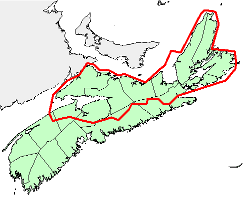
Regional Stream Sediment and Water Survey over the Northern Mainland Nova Scotia and Cape Breton Island
DP ME 136, Version 2, 2006. Regional Stream Sediment and Water Surveys by the Nova Scotia Department of Natural Resources over the Northern Mainland Nova Scotia and Cape Breton Island, 1982-1983
Abstract
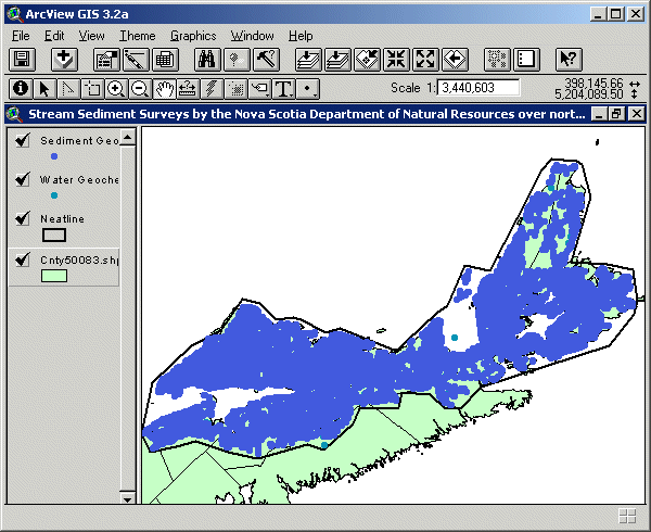
A regional stream sediment and water survey was conducted in northern mainland Nova Scotia and Cape Breton Island in 1982-1983 by the Nova Scotia Department of Mines and Energy for a project funded by the Canada - Nova Scotia Cooperative Mineral Program. Approximately 4100 samples were collected, including standards and duplicates, at a linear spacing of one sample/2 km. Stream samples were analyzed for: Zn, Cu, Pb, Ni, Co, Ag, Mn, As, Mo, Fe, Hg, and U, while stream water samples were analyzed for F and U. There was no stream sediment field survey in 1981. Stream sediment and water samples prefixed by 1981 are a re-analysis of the Department's 1970's stream sediment sampling program (Antigonish, Cape Breton and Cobequid Highlands).
Samples were re-analysed at a new linear spacing of one sample/2 km, instead of the original one sample/300 m linear spacing. The results of the 1982-1983 survey were merged with the re-analysis of the 1981 survey to yield the 1981-83 survey. This data set was previously included as part of a compilation of geochemical surveys and released as DP ME 004 Version 1. This data set previously consisted of str813b1 and stw83b1, which were later renamed to c136nccd and c136nccw. Further information about the survey and analysis can be found in the draft documents: survey_description.wpd, elements.wb3 and fields.wb3 that are supplied with the data set.
Disclaimer
The DATA is provided to the USER on an "as is" basis, without warranties of any kind, express or implied. The entire risk as to the quality and accuracy of the DATA is with the USER and the USER shall use his/her own judgment in making use of the DATA or drawing conclusions based upon it. NR&R shall not be liable to the USER, his/her clients, servants, agents, contractors, assigns, or to any other person for any loss or damage of any kind including personal injury or death arising from the use of the DATA or accompanying written materials, or from errors, deficiencies or faults therein, whether such damage is caused by negligence or otherwise. If errors or omissions are found in the DATA, the USER will notify NR&R. The terms and conditions of the license accompany the downloaded digital product.
Format
ArcInfo Interchange Format (E00), DXF/DBF, ArcView 3.2a shape files (SHP) and TXT files compressed in self-extracting EXE/ZIP files (more information on data formats)
Size
E00 - 0.7 MB (compressed), 3.9 MB (uncompressed)
DXF/DBF - 0.6 MB (compressed), 2.9 MB (uncompressed)
SHP - 0.7 MB (compressed), 4.3 MB (uncompressed)
Projection
The data is in six-degree Universal Transverse Mercator (UTM) projection, Zone 20, Central Meridian 63° 00' West using the North American Datum of 1983 (NAD83).
Downloading Instructions
The data files have been compressed using PKZIP into a single, self-extracting EXE file.
- Read the Licence before accepting the data.
- Download the self-extracting EXE file to the desired location on your hard drive.
- Double click or "RUN" the EXE file and the data files will be unzipped automatically.
The EXE file can also be opened in WinZip to view and extract the compressed files in the data set.
On UNIX platforms, the unzip command will extract the compressed files in the EXE.
All data sets are in six-degree Universal Transverse Mercator (UTM) Zone 20 projection using the NAD83 datum. A readme file and a copy of the licence agreement are also included with each data set.