
TGI-2: Geological Mapping and Resources Evaluation in Central Nova Scotia, 2003-2005
DP ME 185, Version 2, 2006. Digital Geological Data Generated as Part of the Targeted Geoscience Initiative Project (Phase 2), Geological Mapping and Resource Evaluation in Central Nova Scotia, 2003-2005, NTS 11E/06 and 11E/07 and Parts of 11E/05, 11E/10, 11E/11 and 11E/12
Abstract
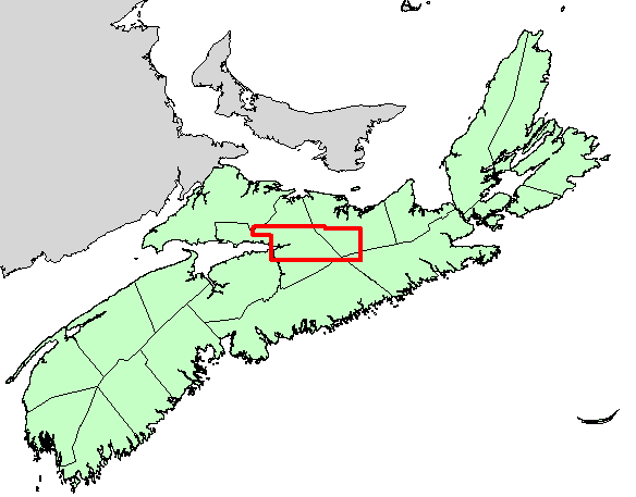
This digital product is a compilation of geological data which was collected as part of the Targeted Geoscience Initiative Project (Phase 2) from 2003-2005. The data was used to create Nova Scotia Department of Natural Resources (NSNR&R) Open File Maps OFM ME 2005-118 and OFM ME 2005-119, compiled by R. D. Naylor, P. S. Giles and D. C. Brisco, 2005. The original digital data was compiled in Fieldlog databases during the project and was later converted by MRB staff into ArcView format. The digital product contains layers for geological features such as: anticlines/synclines, drillholes, faults, bedrock geologic units, geological contacts, mineral occurrences, neatline, outcrops, reference outlines, aggregate samples, spore samples and structural data.
Disclaimer
The DATA is provided to the USER on an "as is" basis, without warranties of any kind, express or implied.
The entire risk as to the quality and accuracy of the DATA is with the USER and the USER shall use his/her own judgment in making use of the DATA or drawing conclusions based upon it.
NR&R shall not be liable to the USER, his/her clients, servants, agents, contractors, assigns, or to any other person for any loss or damage of any kind including personal injury or death arising from the use of the DATA or accompanying written materials, or from errors, deficiencies or faults therein, whether such damage is caused by negligence or otherwise. If errors or omissions are found in the DATA, the USER will notify NR&R.
The terms and conditions of the license accompany the downloaded digital product.
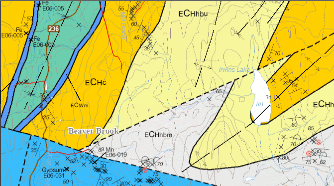
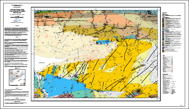
A Sample Image of the Geological Map of the Truro Area (11E/06), OFM ME 2005-118
(Sample image - Click to view an enlargement from this image )
Format
Portable Document Format (PDF), ArcInfo Interchange Format (E00), DXF/DBF, ArcView 3.2a shape files (SHP) and TXT files compressed in self-extracting EXE/ZIP files (more information on data formats)
Size
PDF - 4.3 MB and 4.7 MB (compressed and uncompressed)
E00 - 1.2 MB (compressed), 15.5 MB (uncompressed)
DXF/DBF - 1.4 MB (compressed), 26.2 MB (uncompressed)
SHP - 1.6 MB (compressed), 23.4 MB (uncompressed)
Projection
The PDF map is in six-degree Universal Transverse Mercator (UTM) projection, Zone 20, Central Meridian 63° 00' West using the North American Datum of 1927 (NAD27). All other data (E00, DXF/DBF, SHP) is in six-degree Universal Transverse Mercator (UTM) projection, Zone 20, Central Meridian 63° 00' West using the North American Datum of 1983 (NAD83).
Downloading Instructions
The data files have been compressed using PKZIP into a single, self-extracting EXE file.
- Read the Licence before accepting the data.
- Download the self-extracting EXE file to the desired location on your hard drive.
- Double click or "RUN" the EXE file and the data files will be unzipped automatically.
The EXE file can also be opened in WinZip to view and extract the compressed files in the data set.
On UNIX platforms, the unzip command will extract the compressed files in the EXE.
The PDF map is in six-degree Universal Transverse Mercator (UTM) projection, Zone 20, Central Meridian 63° 00' West using the North American Datum of 1927 (NAD27). All other data (E00, DXF/DBF, SHP) is in six-degree Universal Transverse Mercator (UTM) projection, Zone 20, Central Meridian 63° 00' West using the North American Datum of 1983 (NAD83).