Seawater Intrusion
DP ME 483, Version 1, 2013, Relative Seawater Intrusion Vulnerability compiled by G.W. Kennedy and J. S. McKinnon, 2013. |
|||||||
AbstractA GIS-based approach for broadly evaluating the relative vulnerability of bedrock coastal aquifers to seawater intrusion in unserviced areas of the province was developed. The approach uses available provincial spatial datasets, such as digital elevation models, civic address points and well logs data, to evaluate relative vulnerability based on the following derived criteria: distance to the coast, land slope, development density, non-residential groundwater use and static water level. |
|||||||
DisclaimerThe DATA is provided to the USER on an "as is" basis, without warranties of any kind, express or implied. The entire risk as to the quality and accuracy of the DATA is with the USER and the USER shall use his/her own judgment in making use of the DATA or drawing conclusions based upon it. NR&R shall not be liable to the USER, his/her clients, servants, agents, contractors, assigns, or to any other person for any loss or damage of any kind including personal injury or death arising from the use of the DATA or accompanying written materials, or from errors, deficiencies or faults therein, whether such damage is caused by negligence or otherwise. If errors or omissions are found in the DATA, the USER will notify NR&R. The terms and conditions of the license accompany the downloaded digital product. |
|||||||
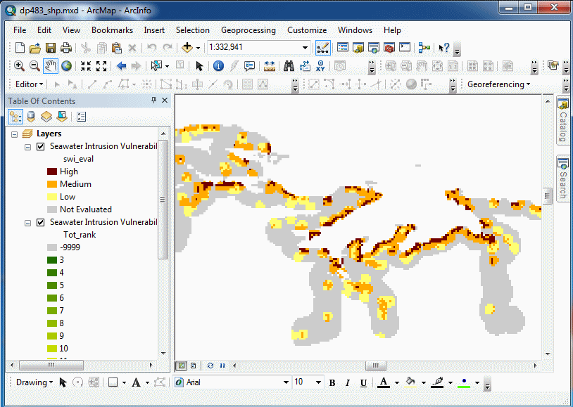
Sample in ArcGIS Destop using the SHP Download
| |||||||
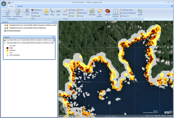
Sample in ArcGIS Explorer using the SHP Download
|
|||||||
Sample in Google Earth using the KML/KMZ Download |
|||||||
Format and Projection
|
|||||||
Downloading InstructionsThe data files have been compressed using PKZIP into a single, self-extracting EXE file.
The EXE file can also be opened in WinZip to view and extract the compressed files in the data set. On UNIX platforms, the unzip command will extract the compressed files in the EXE. All data sets are in six-degree Universal Transverse Mercator (UTM) projection, Zone 20, Central Meridian 63° 00' West using the North American Datum of 1983 (NAD83). A readme file and a copy of the licence agreement are also included with each data set. |
|||||||