
Reading Room 5: List of Maps Outlining the Route, Elevation, Physiography, Bedrock, Glacial and Surficial Geology of Nova Scotia
- Route map of Nova Scotia with place names and stop locations
- Regional bedrock geology of Maritime Canada
- Digital elevation model
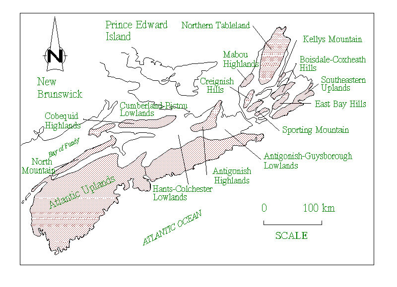
- Physiographic subdivisions of Nova Scotia
- Map of glacial retreat deposits
- Map of glacial advance deposits (stony till plain)
- Map of glacial advance deposits (silty till plain)
- Map of glacial advance deposits (drumlins)
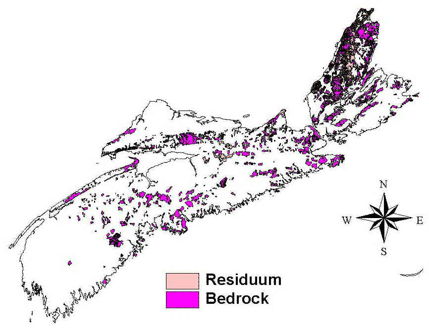
- Map of bedrock areas

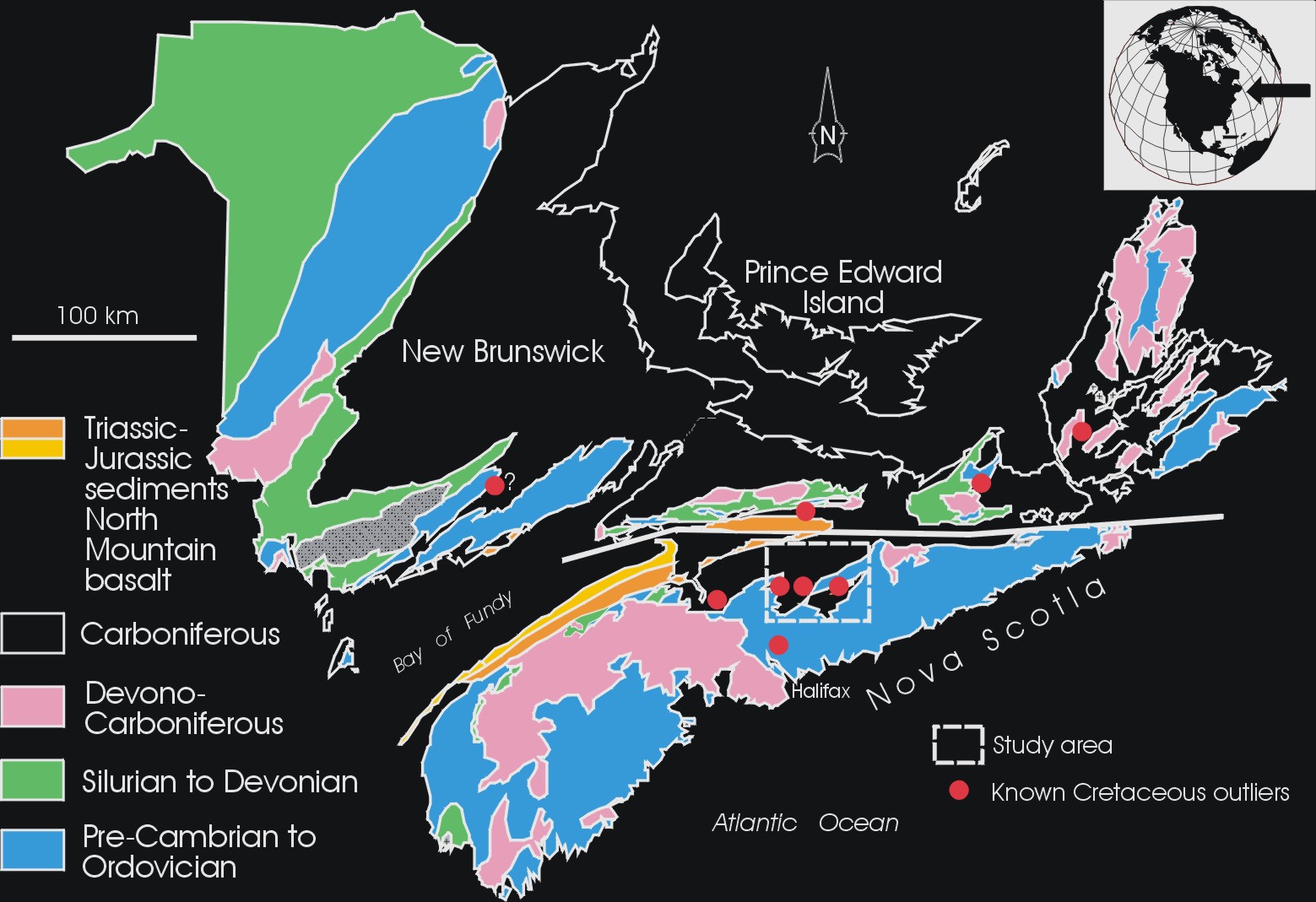
Generalized bedrock geology of the Maritime Provinces, featuring the upland sources of erratics found throughout Nova Scotia. The pink are areas of granititic rocks
[click for full-size image]
Digital elevation model (DEM) image derived from 1:50,000 contours provided by the Nova Scotia Geomatics Centre. DEM image construction by Tim Webster, David Colville and Don Raymond, Nova Scotia Centre of Geographic Sciences (COGS), part of the Nova Scotia Community College network.

[click for full-size image]
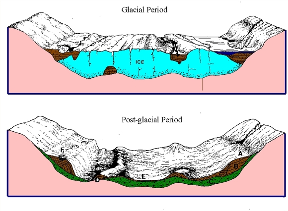
Map of glacial retreat deposits, which include waterlain deposits formed by glacial meltwater streams and debris flow deposits from the ice. These often mark glacier margins. You can download the complete geological map and legends from here. A cartoon describing the glacier processes that form these deposits can be accessed here

[click for full-size image]
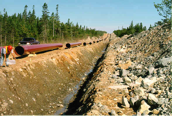
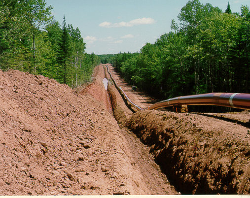
Map of stony till plain deposits, which cover upland areas of the province and regions underlain by hard Pre-Cambrian and Paleozoic rocks. These tills formed under the local ice caps that were prevalent in Nova Scotia during the ice age and are characterized by a loose texture, sandy matrix, and abundant, locally derived, angular stones and boulders. Click here for a picture of these deposits.

[click for full-size image]
Map of silty till plain deposits, which cover large areas of the lowland regions of Nova Scotia. These tills are characterized by a reddish colour and a fine-grained silty clay matrix. Click here for a look at these deposits.

[click for full-size image]
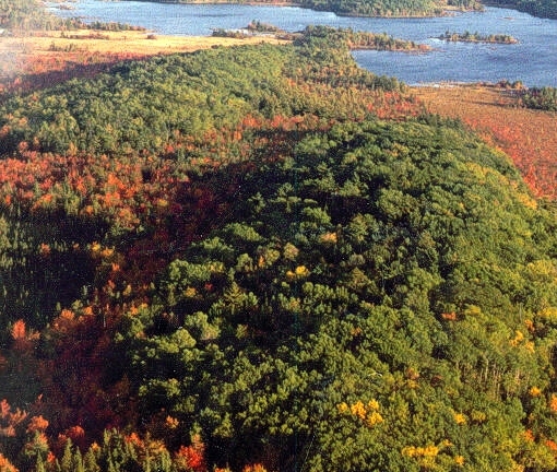
Drumlins are streamlined elongate hills that are oriented parallel to the flow of the glacier that formed them. They are found by the thousands in clusters called drumlin "fields" which form a unique landform type. They are made up of a reddish silty till. Click here for an aerial view of a drumlin field.

[click for full-size image]
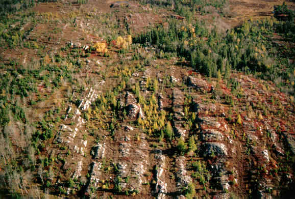
A map of the bedrock and residuum areas of the province. These areas are characterized by bedrock outcrop at or near the surface. Residuum is bedrock that has been mechanically and chemically altered to become soft and unconsolidated. Click here for a typical example of bedrock country.
[click for full-size image]
Go back to the chopper (virtual field trip home page) or
Links Page: other web sites on the landscapes and glacial geology of Nova Scotia.