
Vista 3: Parrsboro Delta and Glaciated Valley
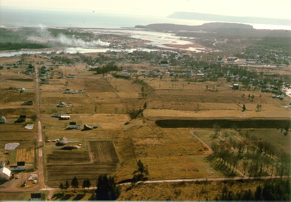
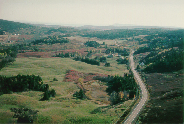
We are flying over Parrsboro (population 1,799), the largest town on the Minas Basin shore. It is the site of the Rockhound Roundup, an annual gathering of rockhounds from all over North America. They come to search for agate, amethyst, zeolites and dinosaur bones found in the Triassic and Jurassic basaltic and sedimentary rocks outcropping along the shores. Parrsboro is located on a huge glacial outwash delta that has been carved into four distinct terrace levels. Spot the terrace levels out the window. The town of Parrsboro and the valley to the north provide some of the most spectacular glacial scenery in Eastern Canada (see map). Let's fly on!
The Parrsboro outwash plain was formed in front of a glacier that sat in the Parrsboro Valley to the north. Soon after ice retreat the land started to rebound. The powerful glacier meltwater streams cut into the deltas, forming terraces as they scythed back and forth across the apron of glacial gravel. Just below us over Port Greville there is a terraced kettle hole. The kettle hole was formed when a chunk of ice left over from the glacier, and surrounded by gravel, melted and left a hole. The terrace above the kettle tells us that rebound was occurring while ice was still melting. This gives us important clues about the timing and rapidity of the Earth's response to glacial loads.

Rapid emergence or rebound began before blocks of ice buried in the outwash had melted. There is also evidence of terracing of ice contact stratified drift north of the delta at a level 18 m lower than the upper delta surface, indicating a drop of 18 m while meltwater was still flowing southward. The rate and uniformity of emergence after the initial uplift is uncertain. The lower two terrace levels in Parrsboro have approximately the same B-horizon soil development, whereas the uppermost two terraces have 20 cm more. This suggests that there may have been a hiatus or a waning in emergence, followed by a another pulse of uplift during the downcutting process. Can you see the three terraces out of the window?
The delta at Parrsboro is poorly exposed because the bulk of it is inland, not eroded at present by the sea. The topset beds are 5 m or more thick, consisting of channel-fill sequences of gravelly sand and sand beds. The topset-foreset contact was only briefly exposed in 1976 at a pit in the southern end of the highest terrace east of the Parrsboro River. These beds were finer grained than the topset beds and dipped 25 degrees to the south. Look at a cartoon of the formation of the Parrsboro delta.
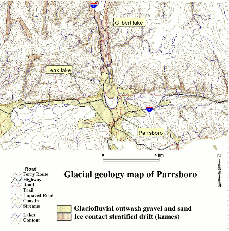
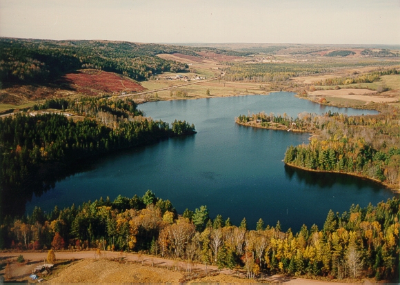
Leak Lake can be seen out the window. It is a kettle lake, formed by the melting out of an ice block. In order to find out when the glaciers retreated, Robert Mott of the Geological Survey of Canada radiocarbon dated small pieces of wood found at the base of the sediment at the lake bottom. He found that the lake sediment started to accumulate around 13 ka (~15.6 CAL). The outwash delta near the lake has channels through it, formed by meltwater streams. Farther north we can see hilly terrain (kames). Kames are deposited at a glacier margin (read a brochure to see how kames form). The former ice edge was located where the outwash plain starts and the kames end (north end of Leak Lake).
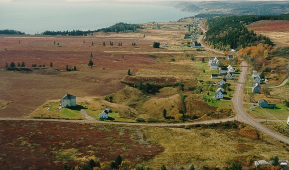
Flying up the valley. Look at the hummocky kame and kettle terrain below us.
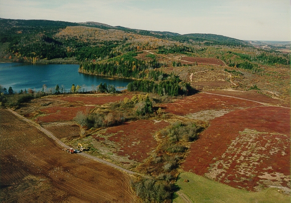
A moraine forms the southern shore of Gilbert Lake (just below us) and also represents the drainage divide between the north-flowing Hebert River and the south-flowing Parrsboro River. This moraine was formed by a re-advance from glaciers north of Parrsboro. This advance cut off the meltwater supply to the Parrsboro delta to the south. The age of the base of Gilbert Lake is about 11.3 ka (read Stea and Mott, (1998) for details). Gilbert Lake is a glacially scoured basin with water depths of greater than 20 m.
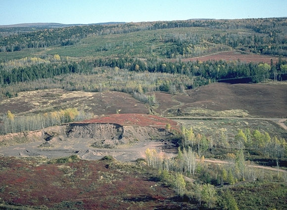
We will touch down on this gravel pit near the moraine. Spectacular kame deposits can be seen along Highway 2 as we approach the moraine. The exposure we will visit is made up of chaotically-bedded gravelly sand and sand with till layers. Faulting and folding of beds has been seen in fresh exposures. How about lunch?
Hop back into the chopper (virtual field trip home page) or
Take Tour 1: The Great Ditch of Nova Scotia.