
Grids for Mineral Claims, Mining Tracts and Petroleum Reservations
DP ME 12, Version 2, 2005. Grids for Mineral Claims, Mining Tracts and Petroleum Reservations in Nova Scotia, compiled by B. E. Fisher.(NAD83)
Abstract
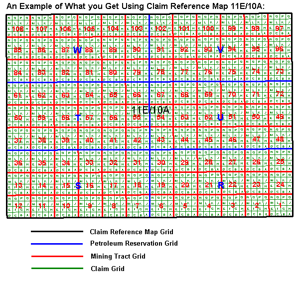
This digital product contains the mineral claim, mining tract and petroleum reservation grids for the Province of Nova Scotia in a UTM NAD83 projection and datum. The NTS 1:50 000 map sheets are each divided into quarters and each of these quarters (labelled A,B,C and D) represent a claim reference map ( DP ME 9 ) upon which claim staking is based in Nova Scotia. Each of these map sheets is then further subdivided for mineral staking into 108 mining tracts with 16 claims on each tract. The map sheet is also divided into 6 grids for use as petroleum reservations. This product contains the polygons that make up each of these grids for Nova Scotia.
Disclaimer
The DATA is provided to the USER on an "as is" basis, without warranties of any kind, express or implied. The entire risk as to the quality and accuracy of the DATA is with the USER and the USER shall use his/her own judgment in making use of the DATA or drawing conclusions based upon it. NR&R shall not be liable to the USER, his/her clients, servants, agents, contractors, assigns, or to any other person for any loss or damage of any kind including personal injury or death arising from the use of the DATA or accompanying written materials, or from errors, deficiencies or faults therein, whether such damage is caused by negligence or otherwise. If errors or omissions are found in the DATA, the USER will notify NR&R. The terms and conditions of the license accompany the downloaded digital product.
Format
ArcInfo Interchange Format (E00), DXF/DBF, ArcView 3.2a shape files (SHP) and TXT files compressed in self-extracting EXE/ZIP files (more information on data formats)
Size
E00 - 1.5 MB to 136 MB (compressed), 5 to 552 MB (uncompressed)
DXF/DBF - 0.8 to 14.2 MB (compressed), 5 to 200 MB (uncompressed)
SHP - 1.3 to 28 MB (compressed), 2.5 to 105 MB (uncompressed)
Projection
The data is in six-degree Universal Transverse Mercator (UTM) projection, Zone 20, Central Meridian 63° 00' West using the North American Datum of 1983 (NAD83).
Downloading Instructions
The data files have been compressed using PKZIP into a single, self-extracting EXE file.
- Read the Licence before accepting the data.
- Download the self-extracting EXE file to the desired location on your hard drive.
- Double click or "RUN" the EXE file and the data files will be unzipped automatically.
The EXE file can also be opened in WinZip to view and extract the compressed files in the data set.
On UNIX platforms, the unzip command will extract the compressed files in the EXE.
All data sets are in six-degree Universal Transverse Mercator (UTM) Zone 20 projection using the NAD83 datum. A readme file and a copy of the licence agreement are also included with each data set.