
Shaded Relief Map of Nova Scotia
DP ME 105, Version 1, 2004. Open File Map ME 2004-1, Shaded Relief Map of Nova Scotia, Compiled by B. E. Fisher, J. C. Poole, J. S. McKinnon and J. A. Beaumont, Scale 1:500 000.
Abstract
This digital product is a digital version of Nova Scotia Department of Natural Resources, Mineral Resources Branch (MRB) Open File Map ME 2004-1, Shaded Relief Map of Nova Scotia, compiled by Brian Fisher, Jeff Poole, Jeff McKinnon and Julie Beaumont, 2004. The digital product was created by the Nova Scotia Department of Natural Resources, Mineral Resources Branch (MRB) staff.
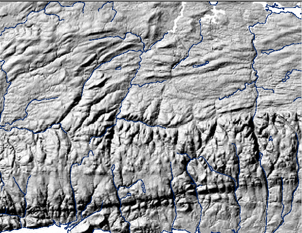
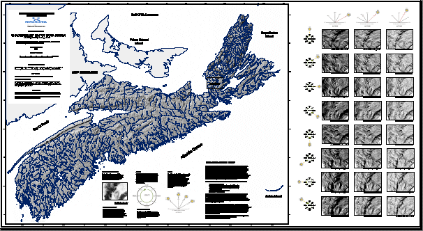
This provincial map uses a 100 metre shaded relief image for all of Nova Scotia. It is shaded from an azimuth of 315 degrees with the sun at an altitude of 45 degrees and uses a vertical exaggeration of 10. It contains smaller image windows that are all shaded relief images, covering the same area, and are derived from a 25 metre DEM. Each window shows shading from a different azimuth and altitude, each with a vertical exaggeration of 10. They are meant to demonstrate the effects on the shaded relief images as the sun moves from one azimuth and altitude to another.
The Mineral Resources Branch has produced a number of shaded relief images in JPEG and MrSID format for the province, gridded at 100 metres (DP ME 057) and 25 metres (DP ME 056), which can be downloaded for free as digital products DP ME 056 and DP ME 057. Metadata about the DEM used to create DP ME 056, 57 and 105 can be downloaded as digital product DP ME 055.
Disclaimer
The information on the PDF map comes from a variety of government and non-government sources. NSNR&R accepts no liability for any errors or deficiencies on this map. This map should not be used for legal purposes.
The PDF map is intended for use at the published scale of 1:50 000.
The DATA is provided to the USER on an "as is" basis, without warranties of any kind, express or implied. The entire risk as to the quality and accuracy of the DATA is with the USER and the USER shall use his/her own judgment in making use of the DATA or drawing conclusions based upon it. NR&R shall not be liable to the USER, his/her clients, servants, agents, contractors, assigns, or to any other person for any loss or damage of any kind including personal injury or death arising from the use of the DATA or accompanying written materials, or from errors, deficiencies or faults therein, whether such damage is caused by negligence or otherwise. If errors or omissions are found in the DATA, the USER will notify NR&R. The terms and conditions of the license accompany the downloaded digital product.
A Sample Image of the Shaded Relief Map of Nova Scotia, OFM ME 2004-1
(Sample image - Click to view an enlargement from this image )
Format
PDF file compressed in self-extracting EXE/ZIP files (more information on data formats)
Size
PDF - 14.2 Mb (compressed), 14.3 Mb (uncompressed)
Projection
This digital product is in six-degree Universal Transverse Mercator (UTM) Zone 20 projection using the North American Datum of 1927 (NAD27).
Downloading Instructions
The data files have been compressed using PKZIP into a single, self-extracting EXE file.
- Read the Licence before accepting the data.
- Download the self-extracting EXE file to the desired location on your hard drive.
- Double click or "RUN" the EXE file and the data files will be unzipped automatically.
The EXE file can also be opened in WinZip to view and extract the compressed files in the data set.
On UNIX platforms, the unzip command will extract the compressed files in the EXE.
All data sets are in six-degree Universal Transverse Mercator (UTM) Zone 20 projection using the NAD27 datum. A readme file and a copy of the licence agreement are also included with each data set.