
Regional Till and Rock Geochemical Survey of the South Mountain Batholith over Western Nova Scotia
DP ME 137, Version 2, 2006. Regional Till and Rock Geochemical Surveys of the South Mountain Batholith by the Nova Scotia Department of Natural Resources over Western Nova Scotia, 1984-1989
Abstract
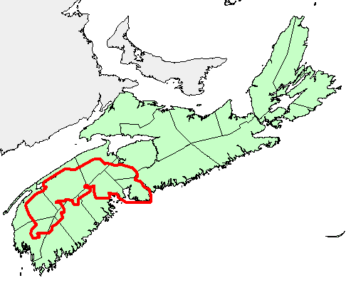
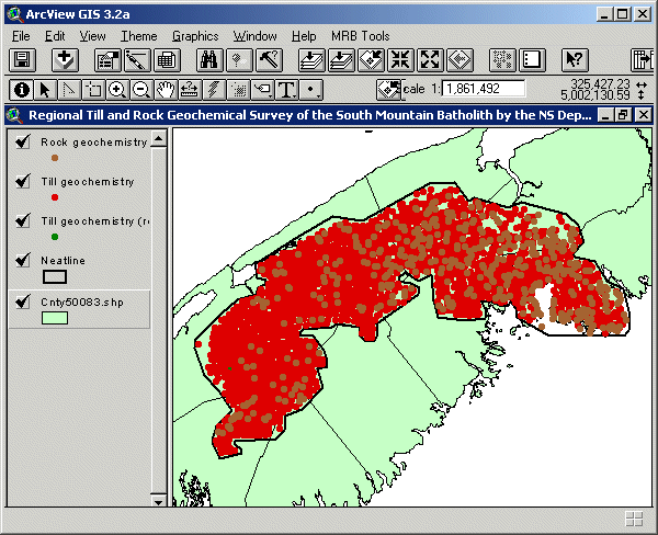
Geological mapping of the South Mountain Batholith (SMB) was undertaken from 1984 to 1989 by the Nova Scotia Department of Mines and Energy under the Canada-Nova Scotia Mineral Development Agreement (CNSMDA). Two geochemical surveys were carried out as part of this project: A regional till survey involved the collection of 2100 samples on a 2 km * 2 km grid over the batholith. These were analyzed for Ni, Cr, Ba, Th, Sc, Pb, Zn, Cu, As, Rb, Sb, Ta, W, Au, U, Fe and Mn. The samples were later re-analyzed for Sn. A second lithogeochem survey was also undertaken. The lithogeochemical samples were collected as part of a detailed mapping program and includes data from the eastern portion of the SMB mapped in 1985 and 1986 and the western portion of the batholith mapped in 1988.
Four hundred and fifty-six samples were collected from the eastern portion of the batholith. These were analyzed for SiO2, Al2O3, Fe2O3, CaO, MgO, Na2O, K2,O, TiO2, P2O5, MnO, Ba, Rb, Sr, Zr, Nb, V, Y, Ga, Cu, Zn, Hf, Ta, Sc, La, Th, U, Li, F, As, Sn and W. This data set was previously included as part of a compilation of geochemical surveys and released as DP ME 004 Version 1. This data set previously consisted of smb_till, snsmb_ti and smb_lith, which were later renamed to c137smct-a, c137smct-b and c137smcr. Further information about the survey and analysis can be found in the draft documents: survey_description_cr.wpd, survey_description_ct.wpd, elements_cr.wb3, elements_ct.wb3, fields_cr.wb3 and fields_ct.wb3 that are supplied with the data set.
Disclaimer
The DATA is provided to the USER on an "as is" basis, without warranties of any kind, express or implied. The entire risk as to the quality and accuracy of the DATA is with the USER and the USER shall use his/her own judgment in making use of the DATA or drawing conclusions based upon it. NR&R shall not be liable to the USER, his/her clients, servants, agents, contractors, assigns, or to any other person for any loss or damage of any kind including personal injury or death arising from the use of the DATA or accompanying written materials, or from errors, deficiencies or faults therein, whether such damage is caused by negligence or otherwise. If errors or omissions are found in the DATA, the USER will notify NR&R. The terms and conditions of the license accompany the downloaded digital product.
Format
ArcInfo Interchange Format (E00), DXF/DBF, ArcView 3.2a shape files (SHP) and TXT files compressed in self-extracting EXE/ZIP files (more information on data formats)
Size
E00 - 0.4 MB (compressed), 2.3 MB (uncompressed)
DXF/DBF - 0.4 MB (compressed), 2.2 MB (uncompressed)
SHP - 0.6 MB (compressed), 2.8 MB (uncompressed)
Projection
The data is in six-degree Universal Transverse Mercator (UTM) projection, Zone 20, Central Meridian 63° 00' West using the North American Datum of 1983 (NAD83).
Downloading Instructions
The data files have been compressed using PKZIP into a single, self-extracting EXE file.
- Read the Licence before accepting the data.
- Download the self-extracting EXE file to the desired location on your hard drive.
- Double click or "RUN" the EXE file and the data files will be unzipped automatically.
The EXE file can also be opened in WinZip to view and extract the compressed files in the data set.
On UNIX platforms, the unzip command will extract the compressed files in the EXE.
All data sets are in six-degree Universal Transverse Mercator (UTM) Zone 20 projection using the NAD83 datum. A readme file and a copy of the licence agreement are also included with each data set.