
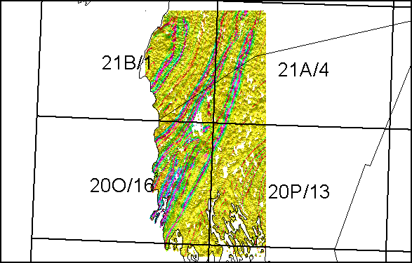
Enhanced Aeromagnetic and Digital Elevation Image of the Yarmouth - Cape St. Mary's Area
DP ME 374, Version 1, 2006. Enhanced Aeromagnetic and Digital Elevation Image Collectively Covering Parts of NTS Map Sheets 21A/04, 21B/01, 20O/09, 20O/16, 20P/12 and 20P/13, Yarmouth - Cape St. Marys Area of Nova Scotia (10 m x 10 m Resolution)
Abstract
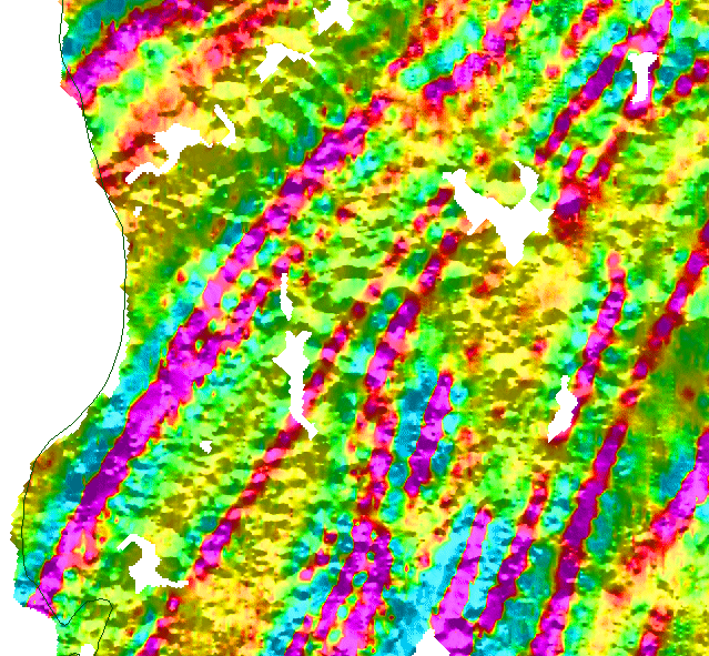
This digital data set consists of a single colour TIFF file, where high resolution aeromagnetic surveys exist over the Yarmouth - Cape St. Marys area in the western Meguma Terrane. The TIFF represents the second vertical derivative of the vertical gradient magnetic data combined with digital elevation data. The original data was collected by aeromagnetic surveys flown by the Geological Survey of Canada (GSC). The data has been gridded to a 10 m cell size. These images were derived from some of the same aeromagnetic surveys as used to create the DP ME 8 and 372 products.
Disclaimer
The information on the PDF map comes from a variety of government and non-government sources. NSNR&R accepts no liability for any errors or deficiencies on this map. This map should not be used for legal purposes.
The PDF map is intended for use at the published scale of 1:50 000.
The DATA is provided to the USER on an "as is" basis, without warranties of any kind, express or implied.
The entire risk as to the quality and accuracy of the DATA is with the USER and the USER shall use his/her own judgment in making use of the DATA or drawing conclusions based upon it.
NR&R shall not be liable to the USER, his/her clients, servants, agents, contractors, assigns, or to any other person for any loss or damage of any kind including personal injury or death arising from the use of the DATA or accompanying written materials, or from errors, deficiencies or faults therein, whether such damage is caused by negligence or otherwise. If errors or omissions are found in the DATA, the USER will notify NR&R.
The terms and conditions of the license accompany the downloaded digital product.
Format
Tag Image File Format (TIFF) and TXT files compressed in self-extracting EXE/ZIP files (more information on data formats)
Size
TIFF - 14.1 MB (compressed), 44.1 MB (uncompressed)
Projection
The TIFF images are in six-degree Universal Transverse Mercator (UTM) projection, Zone 20, Central Meridian 63° 00' West using the North American Datum of 1983 (NAD83).
Downloading Instructions
The data files have been compressed using PKZIP into a single, self-extracting EXE file.
- Read the Licence before accepting the data.
- Download the self-extracting EXE file to the desired location on your hard drive.
- Double click or "RUN" the EXE file and the data files will be unzipped automatically.
The EXE file can also be opened in WinZip to view and extract the compressed files in the data set.
On UNIX platforms, the unzip command will extract the compressed files in the EXE.
A readme file and a copy of the licence agreement are also included with each data set.