DP ME 470, Version 1, 2018. Digital Version of Nova Scotia Department of Natural Resources Open File Map ME 2018-001, Bedrock Geology Map of the Antigonish Highlands Area, Antigonish and Pictou Counties, Nova Scotia, scale 1:75 000, by C.E. White, 2018; Digital Product by C.E. White, A.L. Barras and J.S. McKinnon.
|
|
Disclaimer
Location Map
Sample
Format and Projection
Metadata
Download Instructions
Download Digital Data Set
Related Products
OFM ME 2018-001
|
Abstract
This digital product is a compilation of geological data which was collected as part of the geological mapping in the Antigonish Highlands of northern mainland Nova Scotia initiated in 2010. The data was used to create Nova Scotia Department of Natural Resources (NSNR&R) Open File Map OFM ME 2018-001, compiled by C. E. White. The digital product was created by the NSNR&R, Mineral Resources Branch (MRB) staff from 3 summers of field work by Chris White, and follow-up stratigraphic, geochemical, geochronological, paleontological, and isotopic studies. The digital product contains layers for geological features such as: drillholes, faults, bedrock geologic units, geological contacts, mineral occurrences, neatline, small outcrops and structural data.
The principal goals of this project are to produce a geological bedrock map of the area, to describe and interpret the sedimentary, igneous, metamorphic and deformational history of the area, and to evaluate the area's economic potential. |
|
Disclaimer
The DATA is provided to the USER on an "as is" basis, without warranties of any kind, express or implied.
The entire risk as to the quality and accuracy of the DATA is with the USER and the USER shall use his/her own judgment in making use of the DATA or drawing conclusions based upon it.
NR&R shall not be liable to the USER, his/her clients, servants, agents, contractors, assigns, or to any other person for any loss or damage of any kind including personal injury or death arising from the use of the DATA or accompanying written materials, or from errors, deficiencies or faults therein, whether such damage is caused by negligence or otherwise. If errors or omissions are found in the DATA, the USER will notify NR&R.
The terms and conditions of the license accompany the downloaded digital product.
|
Location Map
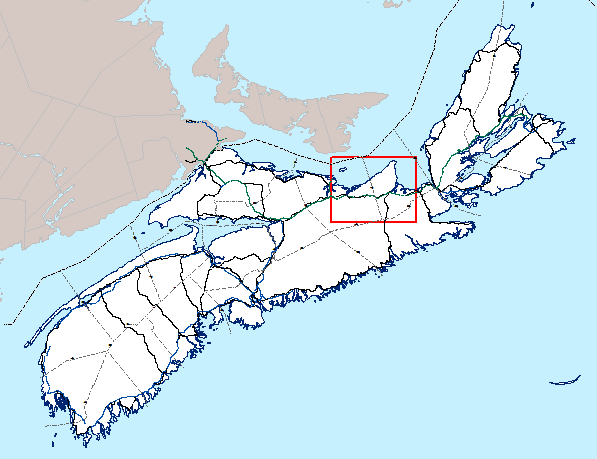
|
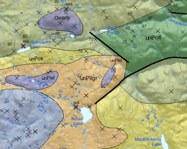
Detailed View
|
| Format |
ESRI shape files (SHP) and ArcGIS File Geodatabase
(GDB) compressed in ZIP files
(more
information on data formats) |
| Size |
SHP and GD - 32.3 MB (compressed), 70 MB (uncompressed)
|
| Projection |
The data is in six-degree Universal Transverse Mercator (UTM) projection, Zone 20, Central Meridian 63° 00' West using the North American Datum of 1983 (NAD83). |
|
Downloading Instructions
The data files have been compressed using IZArc into a single ZIP file.
- Read the Licence before accepting the data.
- Download the ZIP file to the desired location on your computer hard drive.
- Unzip and extract the data onto your computer. We STRONGLY recommend you unzip our data to a consistent area on your hard drive (e.g. C:\nsDNR\).
All data sets are in six-degree Universal Transverse Mercator (UTM) Zone 20 projection using the NAD83 datum.
A readme file and a copy of the licence agreement are also included with each data set. |
Download Digital Data Set DP ME 470
|
