Warwick Mountain Stream Sediment Geochemical Data
DP ME 503 , Version 1, 2018. Stream Sediment Geochemical Data from the Warwick Mountain Area, Eastern Cobequid Highlands, Nova Scotia, by G.J. Baldwin and C.C. MacMullen.Release Date: March 5, 2018, 10 am EST (11 am AST) |
|||||||
|
Related Products |
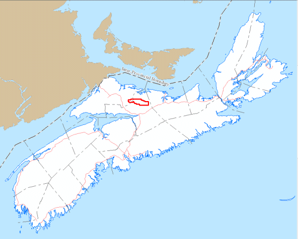
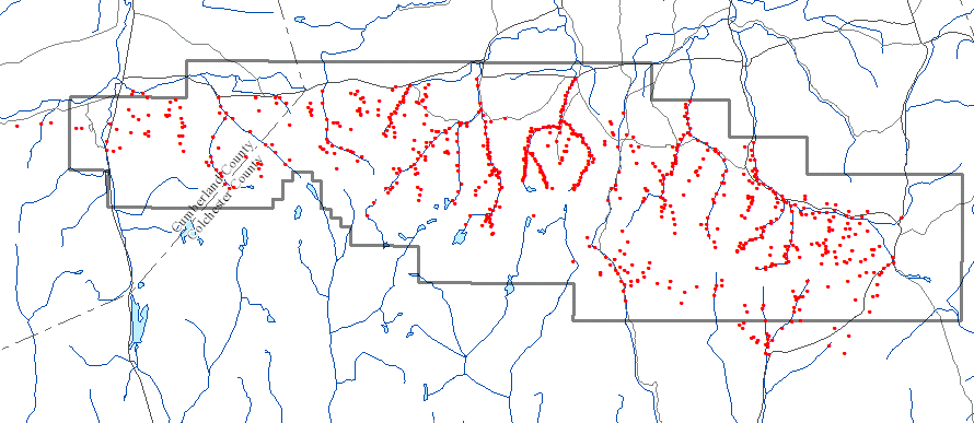
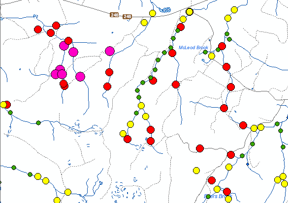
AbstractThis digital product consists of data from a stream sediment geochemical survey undertaken in the fall of 2016 and summer of 2017 by NR&R staff in the Warwick Mountain project area of the eastern Cobequids Highlands of Nova Scotia. It consists of 764 samples with an approximate 1 km2 sampling grid extent taken over the Byers Brook-Diamond Brook volcanic belt. The dataset consists of sample location information, sample descriptions, lab geochemistry for 761 pXRF samples analyzed for S, K, Ca, Ti, V, Cr, Mn, Fe, Ni, Cu, Zn, As, Se, Rb, Sr, Y, Zr, Nb, Mo, Cd, Sn, Sb, Ba, Ce, Pb, Th and a subset of 289 samples for Mo, Cu, Pb, Zn, Ag, Ni, Co, Mn, Fe, As, U, Au, Th, Sr, Cd, Sb, Bi, V, Ca, P, La, Cr, Mg, Ba, Ti, Al, Na, K, W, Sc, Tl, S, Hg, Se, Te and Ga by Aqua Regia assay.
|
||||||
DisclaimerThe DATA is provided to the USER on an "as is" basis, without warranties of any kind, express or implied. The entire risk as to the quality and accuracy of the DATA is with the USER and the USER shall use his/her own judgment in making use of the DATA or drawing conclusions based upon it. NR&R shall not be liable to the USER, his/her clients, servants, agents, contractors, assigns, or to any other person for any loss or damage of any kind including personal injury or death arising from the use of the DATA or accompanying written materials, or from errors, deficiencies or faults therein, whether such damage is caused by negligence or otherwise. If errors or omissions are found in the DATA, the USER will notify NR&R. The terms and conditions of the license accompany the downloaded digital product. |
|||||||
Location Map
|
|||||||
Overview
|
|||||||
Detailed View
|
|||||||
Format and Projection
|
|||||||
Downloading InstructionsThe data files have been compressed using IZArc into a single ZIP file.
All data sets are in six-degree Universal Transverse Mercator (UTM) Zone 20 projection using the NAD83 datum. A readme file and a copy of the licence agreement are also included with each data set. |
|||||||
|
|
|||||||