Lidar DEM and Shaded Relief Images for the Warwick Mountain Area, Nova Scotia
DP ME 507, Version 1, 2018. Lidar DEM and Derived Shaded Relief Images for the Warwick Mountain Area, Eastern Cobequid Highlands, Nova Scotia, compiled by J.C. Poole. |
|||||||
AbstractThis digital product consists of a single lidar bare earth digital elevation model (DEM) and 48 derived shaded relief images over the Warwick Mounatian Area of the eastern Cobequid Highlands of Nova Scotia. The DEM is in a TIFF format with a grid cell size of 1 meter. The DEM was compiled by clipping and merging data from parts of two other lidar surveys: a 2010 Cobequids Highlands survey (DP ME 479, NSGI Project Number 201001) and a 2013 Tatamagouche survey (NSGI Project Number 201301). For more information on the surveys, go to the NSGI DataLocator, Elevation Explorer application (https://nsgi.novascotia.ca/datalocator/elevation/). The 48 shaded relief images are in a JPG format with a grid cell size of 1 meter and were processed at 8 shading azimuths (0, 045, 090, 135, 180, 225, 270, 315) and 3 different altitudes (30°, 45°, 60°). The images were produced with two different vertical exaggerations (5 and 10). The digital product was created by the Nova Scotia Department of Natural
Resources, Geoscience and Mines Branch (GMB) staff. |
|||||||
DisclaimerThe DATA is provided to the USER on an "as is" basis, without warranties of any kind, express or implied. The entire risk as to the quality and accuracy of the DATA is with the USER and the USER shall use his/her own judgment in making use of the DATA or drawing conclusions based upon it. NR&R shall not be liable to the USER, his/her clients, servants, agents, contractors, assigns, or to any other person for any loss or damage of any kind including personal injury or death arising from the use of the DATA or accompanying written materials, or from errors, deficiencies or faults therein, whether such damage is caused by negligence or otherwise. If errors or omissions are found in the DATA, the USER will notify NR&R. The terms and conditions of the license accompany the downloaded digital product. |
|||||||
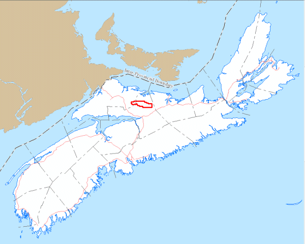
General Location Map
|
|||||||
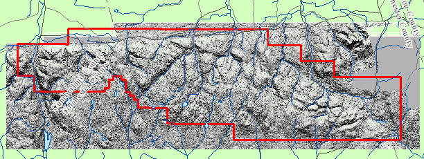
Project Location Map
|
|||||||
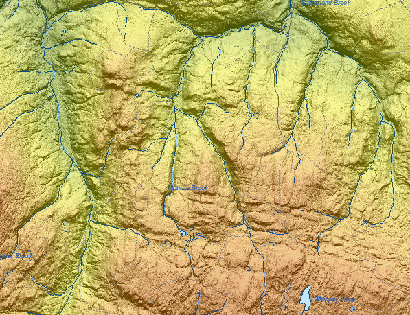
Detailed View (DEM)
|
|||||||
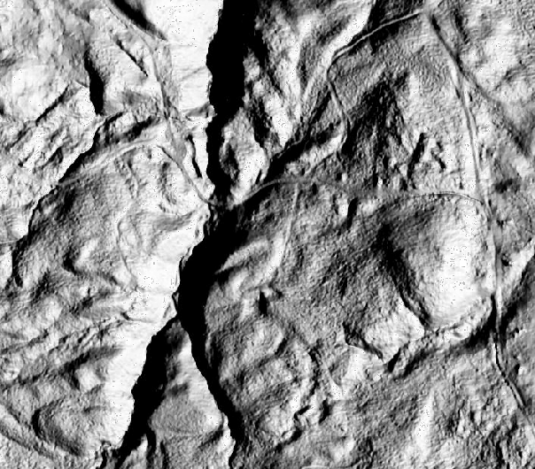
Detailed View (Hillshade)
|
|||||||
Format and Projection
|
|||||||
Downloading InstructionsThe data files have been compressed using IZArc into a single ZIP file.
All data sets are in six-degree Universal Transverse Mercator (UTM) Zone 20 projection using the NAD83 datum. |
|||||||
|
|
|||||||
|
|
|||||||