
Nova Scotia Mine Tailings
Nova Scotia Mine Tailings Database, E. W. Hennick and J. C. Poole, Nova Scotia Department of Natural Resources and Renewables, Digital Product ME 533, Version 2, 2024
Abstract
The Nova Scotia Department of Natural Resources and Renewables (NRR) has identified 219 historical mineral processing sites throughout the province which likely contain mine tailings.
The ore processed at most of the sites (194) was gold, but other commodities include base metals, barite, tin, tungsten, strontium and antimony. Also, areas of coal fines related to several coal wash plants in the Sydney Coalfield, are identified.
Dumps containing waste by-products of past iron and manganese operations are not included, nor are gypsum fines or by-products of steelmaking and power generation, i.e., slag and ash dumps.
In 2009 the Nova Scotia Department of Natural Resources released a series of 64 map sheets of Historic Gold Mining Areas in Nova Scotia https://novascotia.ca/natr/meb/download/mg/ofm/htm/ofm_2009-001.asp This mapping included crusher and tailings locations, but the mapping only represents conditions as identified by the Geological Survey of Canada (GSC) between the years 1884 and 1919. Many of the crushers which pre-dated 1884 and all of those after 1919, are not identified on the maps. Through research, NRR staff have confirmed that much of the tailings created between 1861 and 1884 are identified on the GSC maps, but many locations have been appended to, and others added, particularly for the operations which took place beyond 1919.
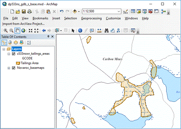
This digital layer of processing sites is intended to indicate the likelihood of tailings existing in an area. In some cases, based upon detailed work contained within various public reports, the polygons are more accurate. However, no detailed studies have been conducted for most sites, thus this digital layer is intended as a guide for potential future delineation or study. The viewer is advised to consult the information sources listed within the database which, in some cases, may be limited to aerial photography or lidar imagery.
Information related to each site includes, location, various companies that operated (if available and not all inclusive), estimated hectares covered, commodity sought, tonnes crushed, dates of operation and sources of information.
Individual crusher locations are not included as part of the database. One site may represent contributions from several different processing operations, e.g., contributions from at least 8 different crushers contributed to the main tailings at Goldenville. Also, in many cases throughout the gold districts it was common practice to erect a mill before producing. In many of those cases the company abandoned the operation before any crushing took place. It was also common for ore from one district to be hauled to crushers in other districts in many instances leading to incorrect production figures for separate districts. In the production field, reconciliations have been made regarding assigning accurate figures to the appropriate site. This may lead readers to note discrepancies between production figures in this dataset compared with those contained in other previously released documentation. Also, in rare cases where no accurate production figures are available, but the site had studies conducted upon it (Seabright reports), the estimated tonnages from the studies are utilized.
Despite evidence of mineral processing, NRR staff were unable to interpret the area covered at 49 sites. At approximately half of those sites the mine tailings went directly into a waterbody making it impossible to estimate the location covered. A simple circular polygon represents the processing site with all available source data identified. However, in other cases, through utilization of historical aerial photography, a reasonable estimation of the area of mine tailings located on or adjacent to, a water body, has been made.
Upon viewing many of the sites it will be apparent that a likelihood exists of mine tailings downstream from many sites. However, unless obviously identifiable through source material, there are no polygons representing downstream coverage, either in rivers, streams, lakes or larger water bodies. The purpose of this layer is to act as a guide for potential better delineation of coverage. In some cases, documentation exists of the existence of mine tailings many kilometres downstream or offshore, from a site.
The dataset makes no reference to potential environmental impacts on the sites but should prove to be an asset for land-use planning and future academic work to possibly better delineate the areas and identify such impacts.
PLEASE NOTE – Further information related to mine tailings in Nova Scotia can be found at the following links, https://novascotia.ca/natr/meb/hazard-assessment/tailings.asp, https://www.novascotia.ca/natr/meb/hazard-assessment/docs/7_-_ofr_me_2015-004.pdf
Many abandoned mineral processing sites contain unsecured open holes and tunnels which present hazards to the public. At some sites, signs on Crown and private land identify the locations of open holes and hazards; however, many more of these abandoned mine openings have no warning signs posted. Anyone who may be traveling in an undeveloped area known to potentially contain abandoned mine openings should review the Nova Scotia Department of Natural Resources Information Circular ME 42, 1995 - https://novascotia.ca/natr/meb/pdf/ic42.asp
Nova Scotia Open Government Licence
This data is made available under the Nova Scotia Open Government Licence.
Use of this data indicates your acceptance to the terms contained in the Nova Scotia Open Government Licence.
Format
ESRI Shapefiles (SHP) and ESRI File Geodatabase 10.8.2 features (GDB), a Google Earth compatible file format (KML\KMZ) compressed in a single ZIP file
(more information on data formats)
Size
SHP/GDB/KML - 1 MB (compressed), 4 MB (uncompressed)
Projection
The data is in six-degree Universal Transverse Mercator (UTM) projection, Zone 20, Central Meridian 63° 00' West using the North American Datum of 1983 (NAD83).
Downloading Instructions
The data files have been compressed using IZArc into a single ZIP file.
- Download the ZIP file to the desired location on your computer hard drive.
- Unzip and extract the data onto your computer. We STRONGLY recommend you unzip our data to a consistent area on your hard drive (e.g. C:\nsdnr\).
All data sets are in six-degree Universal Transverse Mercator (UTM) Zone 20 projection using the NAD83 datum. A readme file and a copy of the licence agreement are included with each data set.