Sediment Thickness and Bedrock Topography Model of Southwest Nova Scotia

DP ME 546, 2023. Data generated by sediment thickness and bedrock topography model of southwest Nova Scotia, by D.M. Brushett, Nova Scotia Department of Natural Resources and Renewables; G.W. Kennedy, Nova Scotia Department of Environment and Climate Change; C.C. MacMullen, Service Nova Scotia.


Licence

Sample

Format and Projection

Metadata

Download Instructions

Download Digital Data Set

Related Links

OFM 2023-002

Abstract

Regional sediment thickness and bedrock topography maps of southern Nova Scotia were generated to aid in mineral, groundwater, and aggregate exploration, geotechnical investigations, aquifer vulnerability, and surficial geological studies. An understanding of the bedrock topography and distribution and thickness of surficial sediments across this region, including parts of Digby, Yarmouth, Shelburne, and Queens counties, will inform these types of investigations.

The bedrock topography of southern Nova Scotia was generated using raster interpolation tools (Natural Neighbour) in the Spatial Analyst extension of ArcGIS 10.8.1. Depth to bedrock data for 9890 records with adequate location accuracy were derived from five sources: The Nova Scotia Well Logs database (n = 2729; NSE, 2022), the Nova Scotia Test Holes database (n = 39; Nova Scotia Department of Natural Resources and Renewables, 2021), the Nova Scotia Drillholes database (n = 1684; O’Neill and Poole, 2016), and bedrock outcrop points from bedrock mapping (n = 5438, White et al., 2012).

Water well log records were filtered for accuracy of location and stratigraphic information; those records with incomplete log descriptions, incomplete location data, or no depth to bedrock data were excluded from analysis. It is important to note that water well drillers in Nova Scotia have only used GPS equipment to reference well locations since 2004, and so desktop spatial referencing of historical water well logs was conducted using property identification information (e.g., civic/lot number). Only those water well records where location accuracy is within 500 m were included. For drillhole database records, depth to bedrock was calculated using overburden depth and dip measurements; those records with incomplete data on location, depth, or dip were excluded. Outcrop points were filtered to exclude those identified as float and those identified as ‘no plot’ for cartographic thinning purposes. Data points are unevenly distributed throughout the study area which makes the bedrock surface difficult to identify where data are sparse.

The sediment thickness of southern Nova Scotia was calculated from the difference between the interpolated bedrock topography surface and the 5 m LiDAR surface elevation data using the raster toolset (minus function) in ArcGIS Spatial Analyst. The sediment thickness model shows the variability in thickness of unconsolidated sediments between the bedrock surface and the present-day land surface, up to a maximum of 76 m. This model also provides details on the regional glacial ice flow and sediment depositional and erosional histories and identifies widespread areas of drumlinized terrain, where drumlin ridges exceeding 40 m in thickness and exhibiting multiple flow directions stand out on the land surface, typically characterized by shallow bedrock with a surficial cover less than 5 m. Glaciofluvial and glaciolacustrine deposits commonly occur in topographic lows, which are now occupied by modern rivers and wetlands.

Nova Scotia Open Government Licence

This data is made available under the Nova Scotia Open Government Licence.

Use of this data indicates your acceptance to the terms contained in the Nova Scotia Open Government Licence.

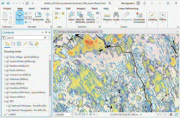
Sample in ArcGIS Pro

Sample Image

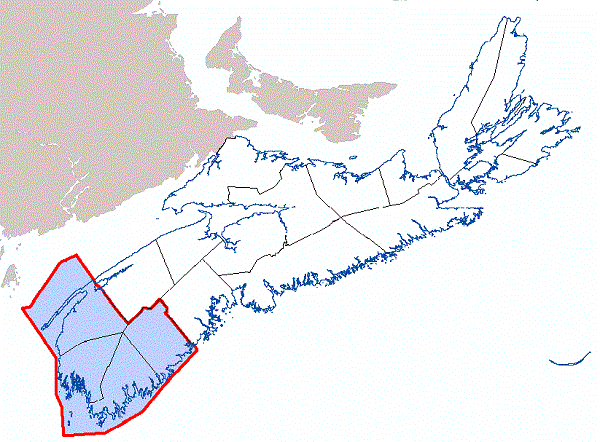
Location Map

Sample Image

Format and Projection

Format ESRI shape files (SHP), ArcGIS File Geodatabase (GDB) files and TIFF (LZW) images compressed ZIP files (more information on data formats)
Size

SHP/GDB/TIFF - 4.8 MB to 2.2 GB (compressed), 34 MB to 2.4 GB (uncompressed)

Projection The data is in six-degree Universal Transverse Mercator (UTM) projection, Zone 20, Central Meridian 63° 00' West using the North American Datum of 1983 (NAD83).

Downloading Instructions

The data files have been compressed into three ZIP files.

All data sets are in six-degree Universal Transverse Mercator (UTM) projection, Zone 20, Central Meridian 63° 00' West using the North American Datum of 1983 (NAD83).

A readme file and a link to the licence agreement are also included with each dataset.

Download Digital Data Set DP ME 546