
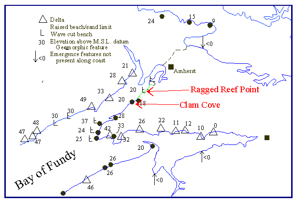
Passing Views from the Chopper 2: Sand Cove Raised Beach

This view is of Sand Cove on the shore of Chignecto Bay. From this vantage point you see a logging road cutting through fine beach sand, above the present high tide marked by the logs at the beach front. This is a raised beach, which attains about 22 m in elevation above the present level of the ocean. Note that this level is almost 20 m lower than Squally Point 20 km southwest. See a map of these deposits.
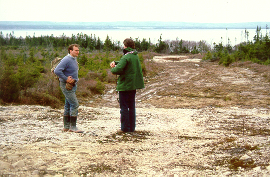
We will make a quick landing on the gravelly beach deposits that mark the highest sea level. Let's imagine that we are in an episode of Star Trek (the first version) and have walked though a time portal. It is 16,000 years ago and waves are lapping up on a former beach near the feet of expendable geologists Smithers and Catano of the Enterprise landing party. They can hear the crash and boom of giant icebergs spalling off the face of a calving glacier a few kilometres up Chignecto Bay. Geologist Catano leaves to investigate a strange noise. A scream is heard as he is assimilated by a salt-craving alien. The two expendable geologists are in fact air wolf and Dr. Darryl Wightman who is explaining sea-level changes during the last glaciation. Note the well-rounded, smoothed white sandstone boulders on the former beach and the sand deposits of the former upper shoreface.
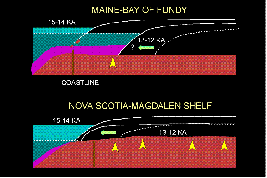
Why is there such a discrepancy in the elevation of the raised beaches at Squally Point and Sand Cove? After all water finds its own level … right? This diagram may explain why. Beach formation was delayed as ice retreated out of Chignecto Bay as the land was rebounding. When the shoreline to the north was finally exposed to the waves, much of the rebound had already happened, and sea-levels were dropping rapidly.
Go back to the chopper (virtual field trip home page) or
Passing Views from the Chopper 3.