Stop 19: Creignish Mountain Lookoff: Northward Ice Flow across the Creignish Hills

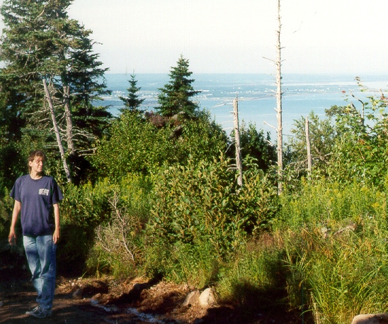
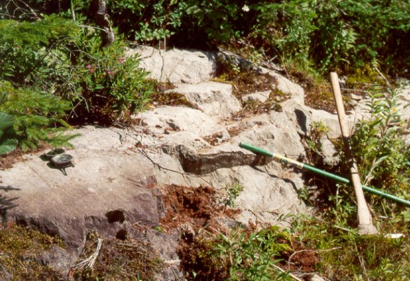
This striated volcaniclastic conglomerate outcrop atop the 300 m high Creignish Hills (Location RS-109/00) in western Cape Breton Island shows that a glacier flowed northwestward, across the hills, into the Gulf of St. Lawrence. From this vantage point you can see Tracadie Harbour across St. Georges Bay. The northward-flowing glacier formed the stony Creignish Hills till and ribbed moraines in this upland belt, which have granite bedrock sources to the east. At location RS 106/00 the Creignish Hills till has 20% granite clasts whose source is 1 km to the southwest or west. The ribbed moraines and stony till are likely to be Late Wisconsinan in age, as there is no evidence that they have been overridden by later glaciers. The minimum age of ~10 ka for the upland surface has been established through lake sediment cores. For a summary of this lake dating work refer to Stea and Mott (1998).
Summary for non-geologists: On top of the Creignish Hills at this scenic lookoff there is rock outcrop with parallel scratches and grooves. These scratches, called striae, were formed at the sliding base of by a large glacier that was centred off the southeast coast of Cape Breton Island. The glacier must have been at least a kilometre thick, in order to flow over these 300 m high hills.

The outcrop shows a well developed lee side, characterized by the jagged and truncated edge nearest the viewer. This is the side facing down-glacier to the northwest, formed by plucking of the rock as the glacier bed decoupled from the bedrock surface. On the surface of the abraded side, glacial striae trend 305°. Other ice flow directional indicators are mini crag and tail features, which are raised ridges behind a hard, protective obstruction. One of these can be seen just in front of the compass.
To put this site in context view the reconstructed late Wisconsinan flow paths for the Scotian Ice Divide.