
Stop 2: Lantz Brick Quarry: Glacial Lake Shubenacadie and the Younger Dryas Climatic Event
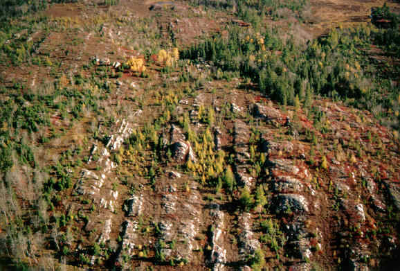
As we fly across Shubenacadie Grand Lake from Stop 1, look out the left window and see the rock ridges on the south side of the lake, made up of Cambro-Ordovician metamorphosed sandstone of the Meguma Group. These sediments were laid down in the ancient Iapetus Ocean off the coast of Africa, before being squeezed and pushed up into mountains by colliding continents 350 million years ago. All that's left of these mountains after millions of years of erosion is the rough, but relatively flat topography of the Atlantic Uplands peneplane.
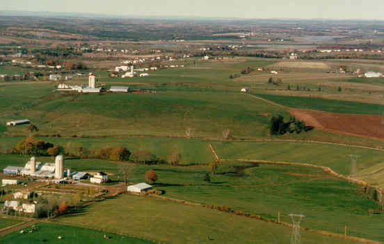
What's happened! The rugged bedrock, forests and lakes are gone, and we see farms and rivers. The land surface is smooth and flat, except for a few drumlins like Nelson Hill above. We are now flying over a lowland region underlain by soft Carboniferous sedimentary rocks and covered by thick glacial deposits. The site is part of the Hants-Colchester Lowland region, which is underlain by Early Viséan Windsor Group rocks including gypsum and limestone. The Lantz brick clay quarry is near the gently undulating flood plain of the Shubenacadie River. There it is … let's land!
Summary for non-geologists: The clay quarry shows three layers of sediment. The lowest layer is a massive clay that was deposited in a large glacial lake (Glacial Lake Shubenacadie), which formed when the mouth of the Shubenacadie River was blocked by glaciers. This glacier ice dam caused meltwater to flood the Shubenacadie Valley to levels of ~30 m and drain southward through the Shubenacadie Canal route to the Atlantic. The lake drained out when the ice dam broke during a period of global warming about 14,000 years ago. Trees and plants had migrated in from New England over the newly exposed landscape. Then, abruptly, just after 13,000 years ago the climate cooled and glaciers re-advanced, again blocking the normal river drainage. A glacial lake re-formed and clay was again deposited over peat (Note: Read the explanation on the age of glacial events; ka = 1000 years).
For more detailed info read Stea and Mott, 1989; Mott and Stea, 1994; Stea and Mott, 1998).
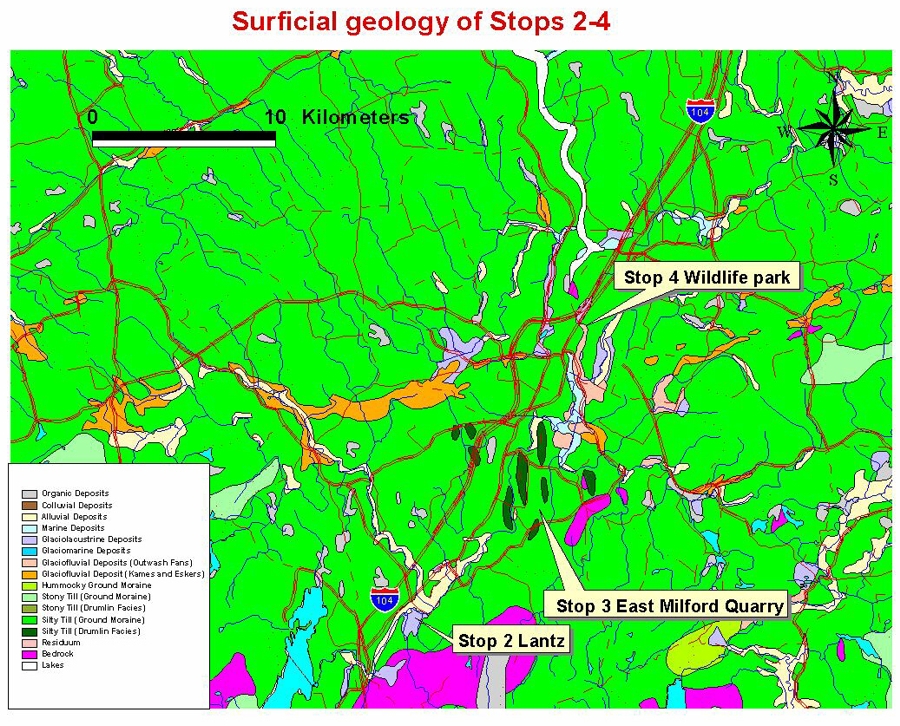
For those of you taking cars and following the chopper (tough job!) take Highway 102 to exit 8 (Elmsvale turnoff), then follow Highway 2 to the village of Lantz. Turn in at the brick quarry. The site is now levelled and access to the pit is restricted, so these pictures will have to do! Look at a location and surficial geology map.
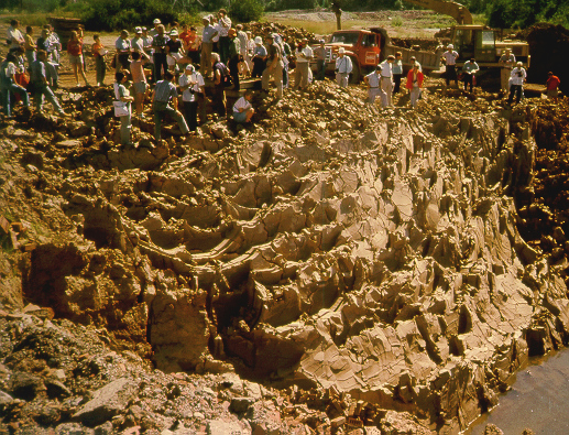
The clay quarry is operated by L. E. Shaw Ltd. Glacial lake (Pleistocene) clay is mined for the manufacture of brick. Stockpiled kaolinitic clay of Cretaceous age and red Carboniferous shale are blended to produce bricks of varying colour and quality.
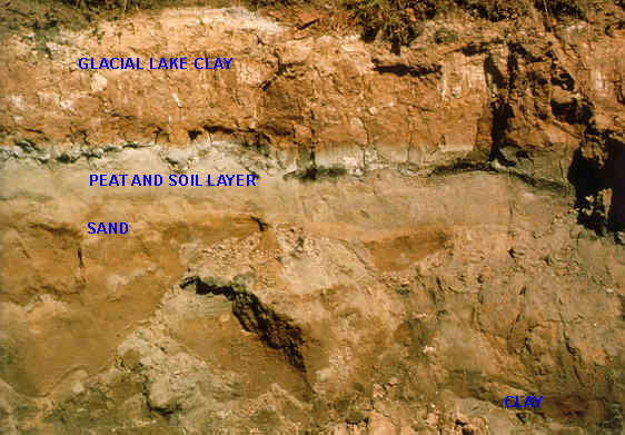
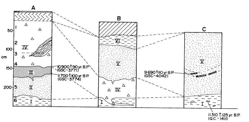
The stratigraphy of the site has been revealed by excavations during the last 15 years. At the base of the quarry is a massive to laminated silty clay (Unit I) with metre thick beds of massive brown clay and thinner (cm) beds of greyish-brown clay-silt-sand.
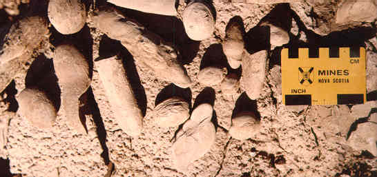
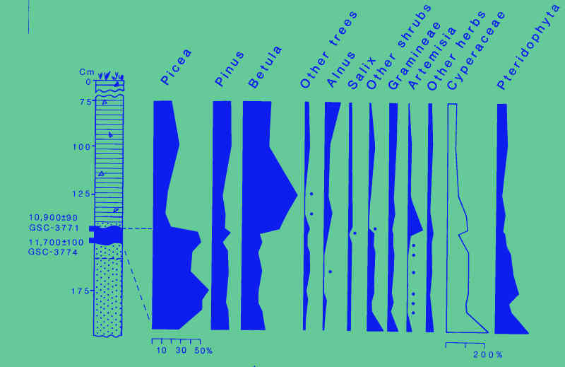
Calcareous concretions are commonly found weathering out of exposed clay blocks. One concretion was radiocarbon dated at 11.314C ka (QC-1411; V. K. Prest, personal communication, 1985). Rootlets were found in the upper 1 m of the clay unit, but these did not continue upward into the overlying sand. Look at a schematic of the stratigraphic section. Auger holes in the area have revealed sand and gravel beds up to 5 m thick underneath the clay.
Lying above the clay is grey to brownish sand (Unit II) which becomes oxidized toward the contact with the overlying clay and peat bed (Unit III). The silty clay beneath the peat is up to 15 cm thick and is sometimes gravelly at the base with a discontinuous greenish-grey clay zone at the peat contact. The peat layer varies in thickness from 0-30 cm, and is faulted in places. Sand up to 15 cm thick, similar in appearance to that immediately beneath the peat layer, overlies the peat bed. One centimetre increments from the base and top of the peat horizon were dated at 11.714C ka (GSC-3774) and 10.914C ka (GSC-3771), respectively.
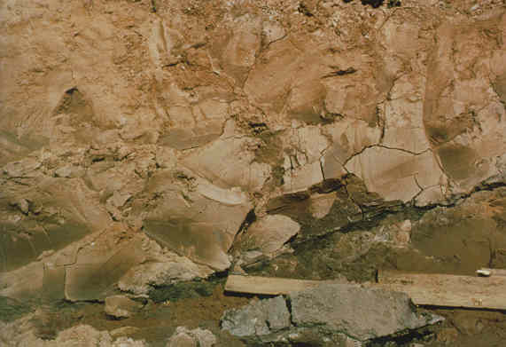
Above the peat is a reddish, blocky, pebbly clay (Unit IV) that becomes sandier toward the top. Sand lenses and thin silty partings occur at the base of the unit along with contorted thin beds of sand and clay. A pocket of steeply dipping, laminated silty clay and sand was found within the massive pebbly clay.
At section B (see schematic) gravelly sand (Unit V) is capped by a reddish clay layer (Unit VI). Organic clay lenses and wood fragments were found in arcuate, channel-fill beds in Unit V. A fragment of poplar/aspen (Populus) sp. from one of these organic layers was dated at 9.714C ka (GSC-4042).
Pollen Analysis
Section A is a pollen profile through the sand, peat and clay sediments. Picea (spruce) becomes abundant above the base of the peat and remains so to the top. Betula (birch) levels decline slightly along with levels for other shrubs and herbs. Cyperaceae (sedges) also decline somewhat but are still relatively abundant. Pinus (pine) pollen, although present throughout the profile, are derived from long distance transport. In the overlying clay (Unit IV), Picea pollen declines abruptly, with a concomitant increase in Betula and various herbs. Size measurements and morphology of the Betula pollen suggest that it probably represents the arctic shrub birch type. Needles of Picea were recovered from the peat, along with seeds of Cyperaceae and Menyanthes trifoliata (J. V. Matthews, Jr., personal communication, 1982).
Interpretation
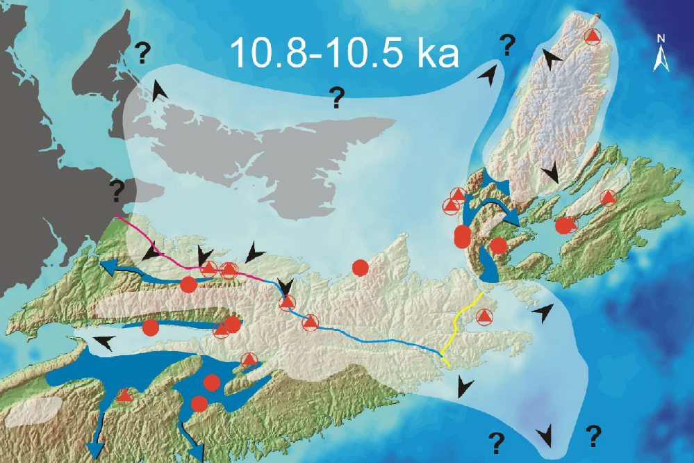
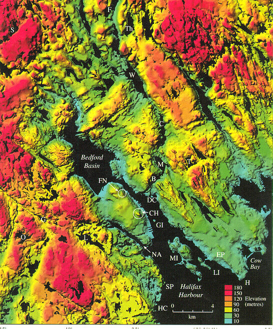
Rhythmic (varved) bedding and lack of fossils in the basal clay (Unit I) at Lantz suggests a glacial lake origin. A large lake formed in the Shubenacadie River valley during regional deglaciation when glaciers blocked northward drainage to the Bay of Fundy (see reconstruction). This lake drained through a trough marked today by a series of lakes that drain into Halifax Harbour (see map).
Stream sand deposition (Unit II) followed breaching of the ice dam and drainage of the lake. Organic deposits (Unit III) began to form about 11.714C ka (~13.8 ka CAL) in shallow ponds and mires that developed in depressions on the former lake plain. Pollen and macrofossil studies indicate that shrub birch and a variety of other shrubs, herbs and ferns bordered wet areas where sedges were abundant. Spruce trees invaded the surrounding area early to form open woodlands with interspersed low shrubs and herbs. An abrupt climatic change occurred about 10.814C ka (~13.9 ka CAL) and caused the decline in spruce trees and increase in shrub birch and other shrubs and herbs, coincident with the change to glacial lake conditions (Unit IV).
The sediments and pollen content of Unit IV imply that it formed in a glacial lake environment and no marine fossils have been found. In order to block free drainage into the Bay of Fundy a re-advance of ice is postulated, forming a second phase of Glacial Lake Shubenacadie between 10.7 and 9.414C ka (~12.9-11.9 ka CAL). Units V and VI, the gravelly-sand and silty-clay units overlying Unit IV, were deposited after 9.514C ka, and probably represent a Holocene flood deposit of the Shubenacadie River.
Go back to the chopper (virtual field trip home page) or