
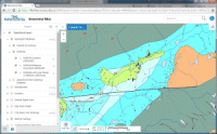
Nova Scotia Drillhole Database
DP ME 3, Version 6, 2023. Nova Scotia Drillhole Database. Digital product compiled by Mick O'Neill, Alex MacKay and Jeff Poole
Related Products/Links
Abstract
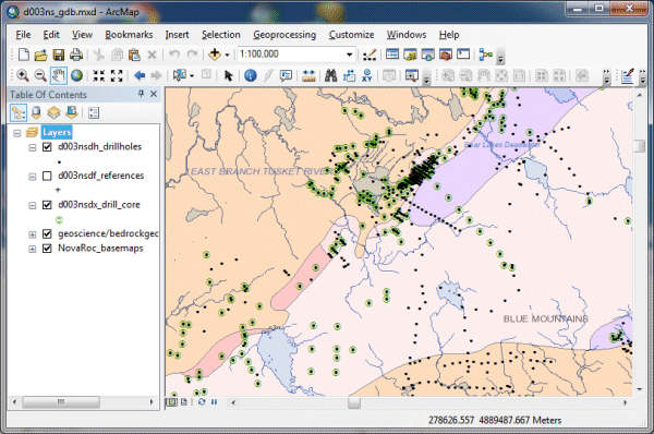
This digital product is developed from a database of published drillhole information for the province of Nova Scotia. The database is maintained by the Nova Scotia Department of Natural Resources (DNR), Geoscience and Mines Branch (GMB). The digital product was created by the DNR GMB staff. The database was developed from information contained in publicly available mineral exploration assessment reports, open file reports and other GMB and Geological Survey of Canada (GSC) publications. The database provides approximate coordinate locations for many of the drillholes, and also provides a source reference on each drillhole. The digital product contains a layer for the drillholes (d003nsdh), a layer for references (d003nsdf) and a layer for drillholes with core (d003nsdx) .
There are 28,341 drillholes in the database and there are over 40,000 references associated with these holes. A single drillhole will have one or more references associated with it. This generally consists of a reference when the hole is drilled and subsequent references when further work is done on the hole (e.g. extensions, geophysics, sampling). There are 6,597 drillholes with core associated with them at the DNRR Core Library in Stellarton.
Nova Scotia Open Government Licence
This data is made available under the Nova Scotia Open Government Licence.
Use of this data indicates your acceptance to the terms contained in the Nova Scotia Open Government Licence.
Format
ESRI shape files (SHP), ArcGIS File Geodatabase 10.8 (GDB), a Google Earth compatible file format (KML\KMZ) and Microsoft Excel spreadsheets (XLS) compressed in a single ZIP file (more information on data formats)
Size
SHP/GDB/KML/XLS - 36 MB (compressed), 426 MB (uncompressed)
Projection
The data is in six-degree Universal Transverse Mercator (UTM) projection, Zone 20, Central Meridian 63° 00' West using the North American Datum of 1983 (NAD83).
Downloading Instructions
The data files have been compressed into a single ZIP file.
All data sets are in six-degree Universal Transverse Mercator (UTM) projection, Zone 20, Central Meridian 63° 00' West using the North American Datum of 1983 (NAD83).
A readme file and a link to the licence agreement are also included with each dataset.