
Enhanced Digital Elevation Model , Nova Scotia, Canada
DP ME 55, Version 2, 2006, Enhanced Digital Elevation Model, Nova Scotia, Canada
Data Format Technical Notes
… Metadata
Abstract
This digital product consists of a hydrologically correct 20m Digital Elevation Model for the provinceof Nova Scotia. Service Nova Scotia and Municipal Relations, Registry and Information Management Services, Nova Scotia Geomatics Centre produced the Enhanced Digital Elevation Model in conjunction with the Department of Natural Resources, the Department of Environment, and the Department of Agriculture and Fisheries.
This product was generated at a resolution of 20 meters and geographically covers the province of Nova Scotia. The Enhanced Digital Elevation Model was developed in the Grid environment of ArcInfo version 7.1 using the topogrid command. This interpolation method generated a hydrologically correct grid of elevation for Nova Scotia. Input coverages were selected from the 1:10 000 Digital Resource Mapping Series.
The input coverages include: elevation points, irregularly spaced approximately 80 meters; elevation points, representing hydrologic features (streams); open water outlines with elevation values (lakes, coastline); breakline features (cliffs); contour lines - 5 meter where applicable; spot heights - where applicable;
Disclaimer
The information on these images may have come from a variety of government and non-government sources. The Nova Scotia Department of Natural Resources does not assume any liability for any errors that may occur.
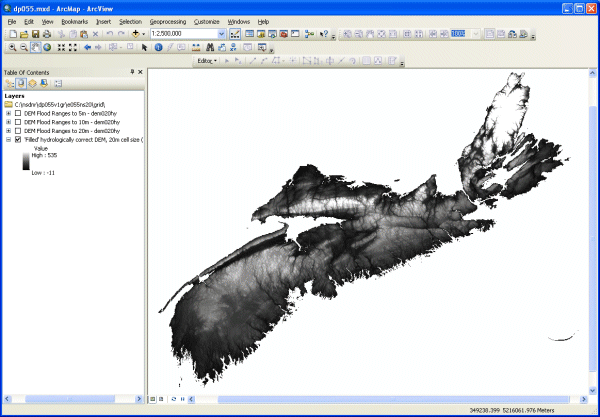
A Sample ArcMap Image
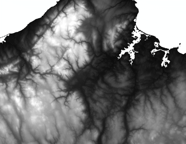
A Sample image - Click to view details in a smaller area
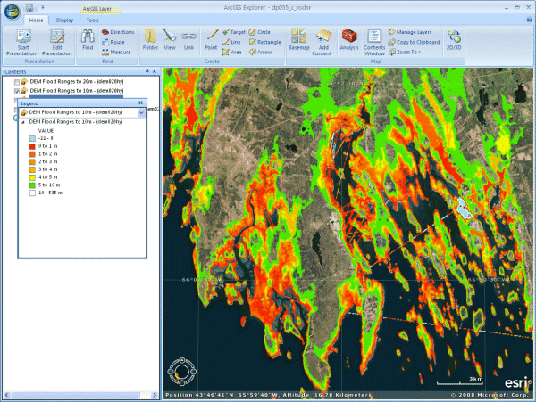
A Sample Flood Model using the DEM in ArcGIS Explorer
Format
ArcInfo Grid, ArcGIS MXD, ArcGIS LYR, HTM, XML, and TXT files compressed in self-extracting EXE/ZIP files (more information on data formats)
Size
59 MB (compressed) and 138 MB (uncompressed)
Projection
The ArcInfo Grids are in six-degree Universal Transverse Mercator UTM) projection, Zone 20, Central Meridian 63° 00' West using the North American Datum of 1983 (NAD83).
Downloading Instructions
The data files have been compressed using PKZIP into a single, self-extracting EXE file.
- Read the Licence before accepting the data.
- Download the self-extracting EXE file to the desired location on your hard drive.
- Double click or "RUN" the EXE file and the data files will be unzipped automatically.
The EXE file can also be opened in WinZip to view and extract the compressed files in the data set. On UNIX platforms, the unzip command will extract the compressed files in the EXE.
\