Geological Mapping of Cape Breton Island
DP ME 433, Version 2, 2021. Digital Geological Data Generated as Part of the Bedrock Geological Mapping Compilation Project for Cape Breton Island, Nova Scotia. Digital product compiled by S. M. Barr, C. E. White, B. E. Fisher, J. S. McKinnon, A. L. Barras and D. S. Hapgood. |
|||||||
|
Related Products |
AbstractThis digital product is a compilation and integration by S.M. Barr and C.E. White of previous field work and detailed bedrock geological mapping initiatives over the last 25 years in Cape Breton Island. The data was used to create Nova Scotia Department of Natural Resources (NSNR&R) Open File Maps OFM ME 2017-007 to 2017-031, compiled by S.M. Barr and C. E. White, 2017. The digital product was created by the NSNR&R, Geoscience and Mines Branch (GMB) staff. The digital product contains layers for geological features such as: anticlines/synclines, coal seams, areas of concentrated drilling, drillholes, faults, bedrock geologic units, geological contacts, mineral occurrences, neatline, small outcrops, reference outlines, structural data, and terrane boundaries. In 2021, a revised edition of the digital product was released with updates made to bedrock geology, contacts, and faults in the Baddeck area. The updated data was used to replace OFM ME 2017-006 and OFM ME 2017-019 with OFM ME 2021-003 and OFM ME 2021-004 respectively. |
||||||
Nova Scotia Open Government LicenceThis data is made available under the Nova Scotia Open Government Licence. Use of this data indicates your acceptance to the terms contained in the Nova Scotia Open Government Licence. |
|||||||
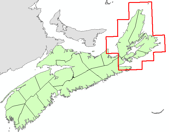
Location Map
|
|||||||
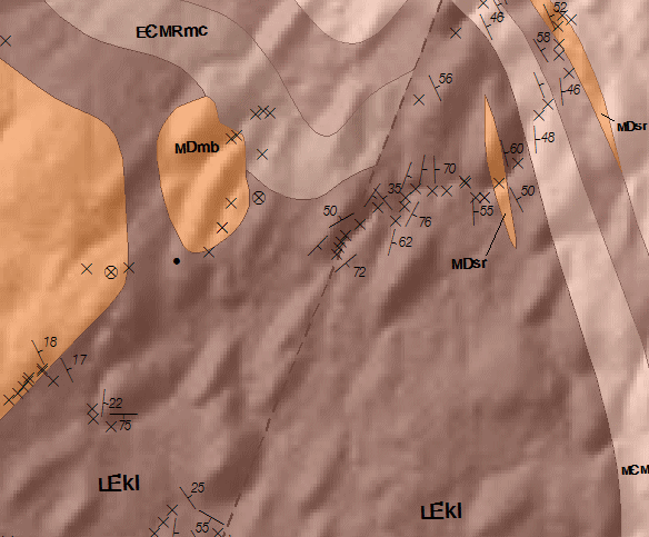
Detailed View
|
|||||||
Format and Projection
|
|||||||
Downloading InstructionsThe data files have been compressed using IZArc into a single ZIP file.
All data sets are in six-degree Universal Transverse Mercator (UTM) Zone 20 projection using the NAD83 datum. A readme file and a copy of the licence agreement are also included with each data set. |
|||||||
|
|
|||||||