Geoheritage Sites of Nova Scotia
DP ME 477, Version 1, 2017, Geoheritage Sites of Nova Scotia by J. H. Calder and J.C. Poole. |
|||||||
|
Metadata Attribute Information Related Products |
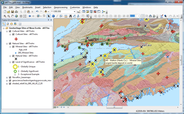
AbstractThis digital product was derrived from the Nova Scotia Geoheritage List and represent sites that tell the story of the geological and cultural evolution of Nova Scotia, and in some cases of planet Earth itself. The list comprises both natural geological sites and cultural sites that commemorate or explore the ties that the people of Nova Scotia have with the Earth and with geological resources that have shaped our history. Natural sites are categorized by three levels of significance: (1) globally unique, (2) globally or internationally significant; and (3) exceptional examples of geological phenomena. The list draws upon the collective wisdom of many geoscientists and interested public, over many years of exploration of Nova Scotia’s varied geology, many of which were recorded on the Geological Highway Map of Nova Scotia published by the Atlantic Geoscience Society. More detailed information about these Geoheritage Sites and other Geoheritage Resources for the province of NovaScotia is avalable at https://novascotia.ca/natr/meb/geoheritage-resources/. Fossils in Nova Scotia are protected under the Special Places Protection Act (https://cch.novascotia.ca/exploring-our-past/special-places); collecting requires a heritage research permit from the Nova Scatia Museum. (https://cch.novascotia.ca/exploring-our-past/special-places/palaeontology-permits-and-guidelines) When visiting a Geoheritage Site, please obtain the permission of the landowner. Please follow the outdoors ethics principles of Leave No Trace Canada.(http://www.leavenotrace.ca) |
||||||
DisclaimerThe DATA is provided to the USER on an "as is" basis, without warranties of any kind, express or implied. The entire risk as to the quality and accuracy of the DATA is with the USER and the USER shall use his/her own judgment in making use of the DATA or drawing conclusions based upon it. NR&R shall not be liable to the USER, his/her clients, servants, agents, contractors, assigns, or to any other person for any loss or damage of any kind including personal injury or death arising from the use of the DATA or accompanying written materials, or from errors, deficiencies or faults therein, whether such damage is caused by negligence or otherwise. If errors or omissions are found in the DATA, the USER will notify NR&R. The terms and conditions of the license accompany the downloaded digital product. |
|||||||
Detailed View
|
|||||||
Format and Projection
|
|||||||
Downloading InstructionsThe data files have been compressed using PKZIP into a single, self-extracting EXE file.
The EXE file can also be opened in WinZip to view and extract the compressed files in the data set. On UNIX platforms, the unzip command will extract the compressed files in the EXE. All data sets are in six-degree Universal Transverse Mercator (UTM) Zone 20 projection using the NAD83 datum. A readme file and a copy of the licence agreement are also included with each data set. |
|||||||
|
|
|||||||