
Stop 1: Halifax Harbour and the Atlantic Uplands

We will turn the chopper towards the northwest to get a good view of Halifax Harbour. Georges Island, a partially submerged drumlin, is in the foreground. (Go to the reading rooms for drumlin definitions.
Since the arrival of the first inhabitants, Halifax Harbour was valued for its natural beauty and utility. The Mik'maq settled seasonally on the inlet to exploit its fisheries. In 1607, Champlain described the harbour, then known as "Chebooktook" and later as "Chebucto", as "a very safe bay". A British garrison established Halifax town and fortress in 1749, with a lumber mill on the opposite side of the harbour. This British North Atlantic military stronghold countered the French fortress of Louisbourg on Cape Breton Island. Halifax was chosen as a site for the British garrison because of its geological attributes. The most distinctive feature is its large, deep, navigable harbour, carved by rivers, enlarged by glacial action, and finished by geologically recent relative sea-level rise. The depth and extent of the harbour led early explorers to estimate that it could hold "1000" ships, an estimation borne out in World War II when it was used as a staging area for cross-Atlantic ship convoys.
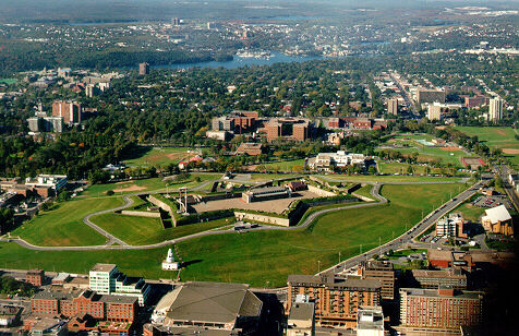
Another reason why Halifax was chosen as the site for the garrison is a drumlin known as Citadel Hill (seen out of the chopper window)which provided the British soldiers with a sweeping view of the harbour and its approaches. The soldiers who were ordered to dig moats around the incipient fortress were lucky that the hill was constructed by glaciers of a soft muddy till, rather than solid rock!
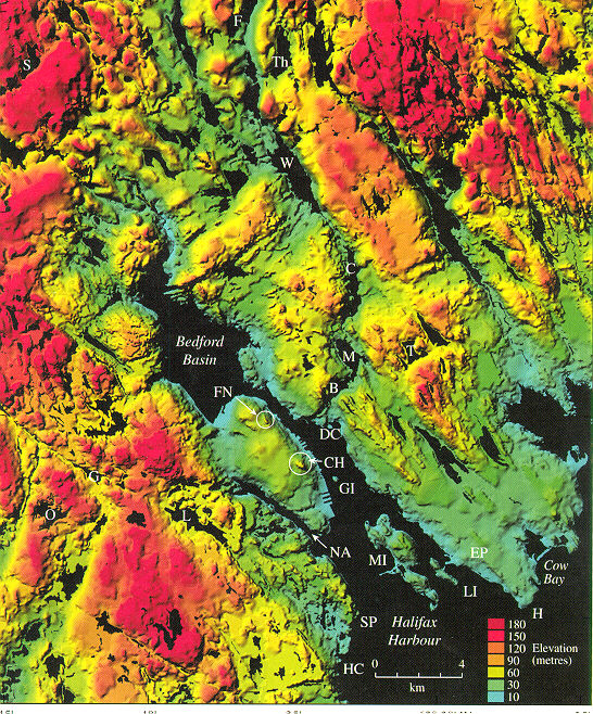
Metropolitan Halifax is located along a rugged, low relief fjord coastline, created as post-glacial sea-level rise drowned glacially modified river valleys. The outer Atlantic coast is highly irregular at a small scale, with numerous embayments such as Bedford Basin in Halifax Harbour or St. Margarets Bay to the west. The coast is fronted in some areas by many small bedrock islands, reflecting the complex bathymetry of the inner shelf. The rivers of the Atlantic coast are incised into Paleozoic rocks of the Meguma Terrane. These rocks form a broad, upland region with a relatively flat surface which slopes from about 300 m inland to sea level on the Atlantic coast. This surface is a "peneplane" termed the Southern or Atlantic Uplands. This flattened bedrock surface is a result of many cycles of uplift and erosion, the last major event being in the Tertiary when the uplands were exhumed from under a thick cover of Cretaceous sediments. The map on the left is a digital terrain model, giving us a picture of the typical terrains of the Atlantic coast in the vicinity of Halifax. Click on it for a close up!
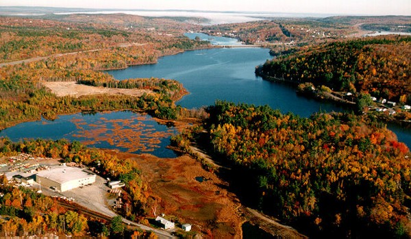
After this stop we will fly up the chain of lakes in Dartmouth, including Lake Banook, Lake Williams and Lake Charles, to another major physiographic region of Nova Scotia. These lakes are all that remain of a once continuous river or spillway from Glacial Lake Shubenacadie, an ice-dammed lake that filled in the lowlands to the north at the end of last glaciation. More on that at the next stops!
Go to Stop 2: Lantz brick quarry in the Hants Lowlands, or
read on about the surficial geology of the Halifax area, particularly the nature of glacial landforms and deposits.
What's under the surface, or
The hunt for red till October?

There are basically two types of glacial deposits and landforms in the Halifax area: drumlins and stony till plain. The rest of the area is just plain bedrock. Look at a map of the surficial deposits. Sea cliff exposures of drumlins in the Halifax-Dartmouth area like the one we see out of the window on the right)show two and sometimes three distinct till layers. The lowest unit is a hard, grey silty till called the Hartlen Till formed during the Early Wisconsinan Caledonia Phase. A reddish, muddy till unit overlying the Hartlen Till is called the Lawrencetown Till and it was deposited during the Late Wisconsinan Escuminac Phase. It is distinguishable from the Hartlen Till by a higher clay content, reddish colour and high erratic content. (Erratics are boulders that have been transported from distant bedrock sources). Granite, diorite, and volcanic boulders are found in the Lawrencetown Till, that originated from the Cobequid Highlands, 80 km north of Halifax. The third unit in this till trilogy is a bouldery, sandy till called the Beaver River Till, which has a predominately local bedrock content and was formed by our own Nova Scotia glacier!
For more information on the bedrock, surficial and engineering geology of the Halifax region: Look up the Lewis and others reference in the list, or visit the Geological Survey of Canada (Atlantic) website.
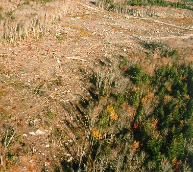
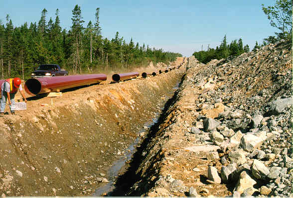
The surface expression of the Beaver River Till in regions north of the Halifax Peninsula is irregular, hummocky topography with large quartzite or granite boulders (up to 10 m in diameter) strewn on the surface (stony till plain). Look at a typical stony till plain out of the left chopper window! For a close-up view of the Beaver River Till, take a virtual flier on the Maritimes and Northeastern Sable Gas Pipeline route.
Go back to the chopper (virtual field trip home page) or