
Geochemistry
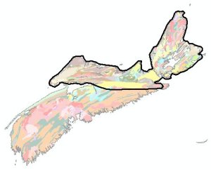
DP ME 129 - Biogeochemical Survey over the Eastern Meguma Terrane
DP ME 129, Version 2, 2006, Biogeochemical Survey by the Nova Scotia Department of Natural Resources over the Eastern Meguma Terrane of Nova Scotia, 1987. Digital product compiled by B. E. Fisher.
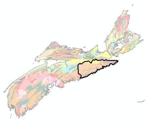
In 1987, a biogeochemical survey was conducted by the Nova Scotia Department of Natural Resources over the Eastern Meguma Terrane of Nova Scotia. Samples were acquired at 2 km intervals along all drivable roads and tracks covering a 5000 km2 area of the eastern Meguma Terrane.
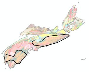
DP ME 130 - Biogeochemical Survey over Southwestern N.S.
DP ME 130, Version 2, 2006, Reconnaissance Biogeochemical Survey by the Geological Survey of Canada over southwestern Nova Scotia, 1991. Digital product compiled by B. E. Fisher.
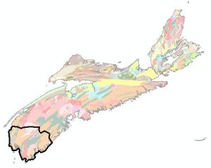
A reconnaissance biogeochemical survey was conducted during a 3 week period beginning in early May 1991, and was funded by the Geological Survey of Canada as a Contribution to Canada - Nova Scotia Cooperation Agreement on Mineral Development 1990-1992, a subsidiary agreement under the Economic and Regional Development Agreement.
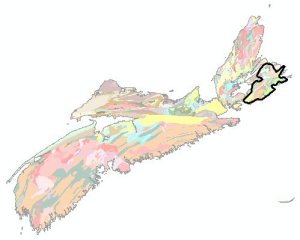
DP ME 131 - Biogeochemical Survey over Southeastern Cape Breton
DP ME 131, Version 2, 2006, Reconnaissance Biogeochemical Survey by the Geological Survey of Canada over southeastern Cape Breton Island, Nova Scotia, 1991. Digital product compiled by B. E. Fisher.
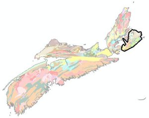
A reconnaissance survey in southwestern Nova Scotia was conducted in late May to mid -June, 1991, by the Geological Survey of Canada (GSC) under the Canada - Nova Scotia Cooperation Agreement in Mineral Development (1990 - 1992). Samples were collected at 2 km intervals, and at least 50m from a highway or 10 km from a little used track, with black spruce bark being used as the principal sample medium.
DP ME 132 - Regional Lake Sediment over Southern N.S.
DP ME 132, Version 2, 2006, Regional Lake Sediment Geochemical Survey by the Nova Scotia Department of Natural Resources over southern Nova Scotia, 1977-1978. Digital product compiled by B. E. Fisher.
A regional centre lake bottom sampling survey was conducted in the Meguma zone in southern Nova Scotia from 1977-1978 and was funded by the 1975-1980 Canada Department of Regional Economic Expansion - Nova Scotia (DREE-NS) Mineral Development Agreement. A two-square mile grid was used in assuring that a representative sampling density was maintained.
DP ME 133 - Regional Lake Sediment over Eastern Cape Breton
DP ME 133, Version 2, 2006, Regional Lake Sediment and Water Geochemical Survey by the Nova Scotia Department of Natural Resources over eastern Cape Breton, 1983-1985. Digital product compiled by B. E. Fisher.
A regional lake sediment and lake water sampling program was completed for eastern Cape Breton Island in 1983 by the Geological Survey of Canada and Nova Scotia Department of Mines and Energy Joint Project under the Canada - Nova Scotia Co-operative Mineral Program 1981-1984.
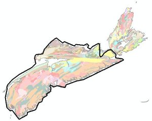
DP ME 134 - Compilation of Till and Soil Data over Meguma Terrane
DP ME 134, Version 2, 2006, Compilation of Seabright Resources Inc. Till and Soil Geochemical Data by the Nova Scotia Department of Natural Resources over the Meguma Terrane, Nova Scotia, 1986-1988. Digital product compiled by B. E. Fisher.
A till and soil geochemical survey was conducted over the Meguma Terrane in Nova Scotia between 1986-1989 by the staff of Seabright Resources Inc. and Seabright Explorations Inc. Till and soil samples were collected at 4 455 sample sites in the Meguma Terrane.
DP ME 135 - Bulk Stream Sediment over Northern N.S.
DP ME 135, Version 2, 2006, Geochemical Analyses of Bulk Stream Sediment and Water Samples by the Nova Scotia Department of Natural Resources over northern Nova Scotia, 1986-1987. Digital product compiled by B. E. Fisher.
A regional stream sediment and water survey was carried out on northern mainland Nova Scotia and on Cape Breton Island between 1986-1987 with funding from the Geological Survey of Canada through the 1984-89 Canada - Nova Scotia mineral Development Agreement.
DP ME 136 - Regional Stream Sediment over Northern N.S.
DP ME 136, Version 2, 2006, Regional Stream Sediment and Water Surveys by the Nova Scotia Department of Natural Resources over the northern mainland Nova Scotia and Cape Breton Island, 1982-1983. Digital product compiled by B. E. Fisher.
A regional stream sediment and water survey was conducted in northern mainland Nova Scotia and Cape Breton Island in 1982-1983 by the Nova Scotia Department of Mines and Energy for a project funded by the Canada - Nova Scotia Cooperative Mineral Program. Approximately 4100 samples were collected, including standards and duplicates, at a linear spacing of one sample/2 km.
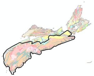
DP ME 137 - Regional Till and Rock Surveys over Western N.S.
DP ME 137, Version 2, 2006, Regional Till and Rock Geochemical Surveys of the South Mountain Batholith by the Nova Scotia Department of Natural Resources over western Nova Scotia, 1984-1989. Digital product compiled by B. E. Fisher.
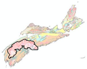
Geological mapping of the South Mountain Batholith (SMB) was undertaken from 1984 to 1989 by the Nova Scotia Department of Mines and Energy under the Canada-Nova Scotia Mineral Development Agreement (CNSMDA). Two geochemical surveys were carried out as part of this project: A regional till survey involved the collection of 2100 samples on a 2 km * 2 km grid over the batholith.
DP ME 138 - Till survey over Mainland N.S.
DP ME 138, Version 2, 2006, Till Geochemical Survey by the Nova Scotia Department of Natural Resources over mainland Nova Scotia, 1977-1982. Digital product compiled by B. E. Fisher.
A surficial mapping and till geochemistry program covering the southern mainland Meguma Terrane in Nova Scotia, was conducted from 1977-1982 by the Canada Department of Regional Economic Expansion and Nova Scotia Department of Mines. Surficial mapping and trace element analysis of till deposits in northern mainland Nova Scotia was conducted from 1982-1985.